National Geographic
National Geographic Adventure Map Khumbu AD00003002
National Geographic Adventure Map Khumbu AD00003002
Couldn't load pickup availability
National Geographic Adventure Map Khumbu AD00003002
• Waterproof • Tear-Resistant • Travel Map
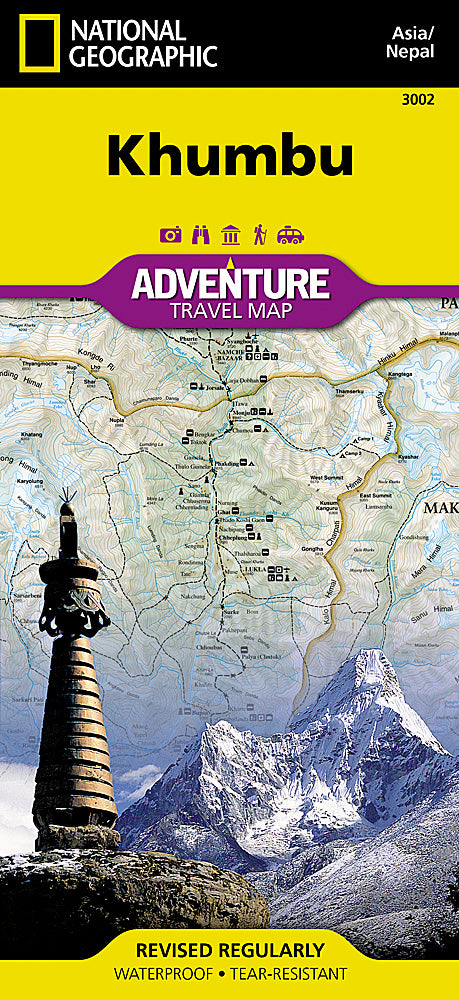
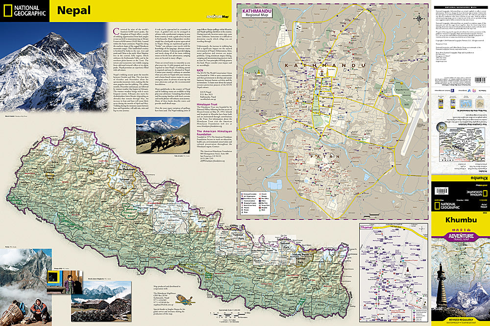
The Khumbu region of Nepal, also known as the Everest Region, lies on the Nepalese side of Mount Everest. Explore this fascinating destination in remarkable detail with National Geographic's Khumbu Adventure Map. Cities and towns are easy to find with the map's helpful index. Major and minor roads as well as trekking routes are clearly designated so travelers can easily plan their best route. Specialty content such as diverse and unique recreational, ecological, cultural, and historical destinations make Adventure Maps the perfect companion to a guidebook.
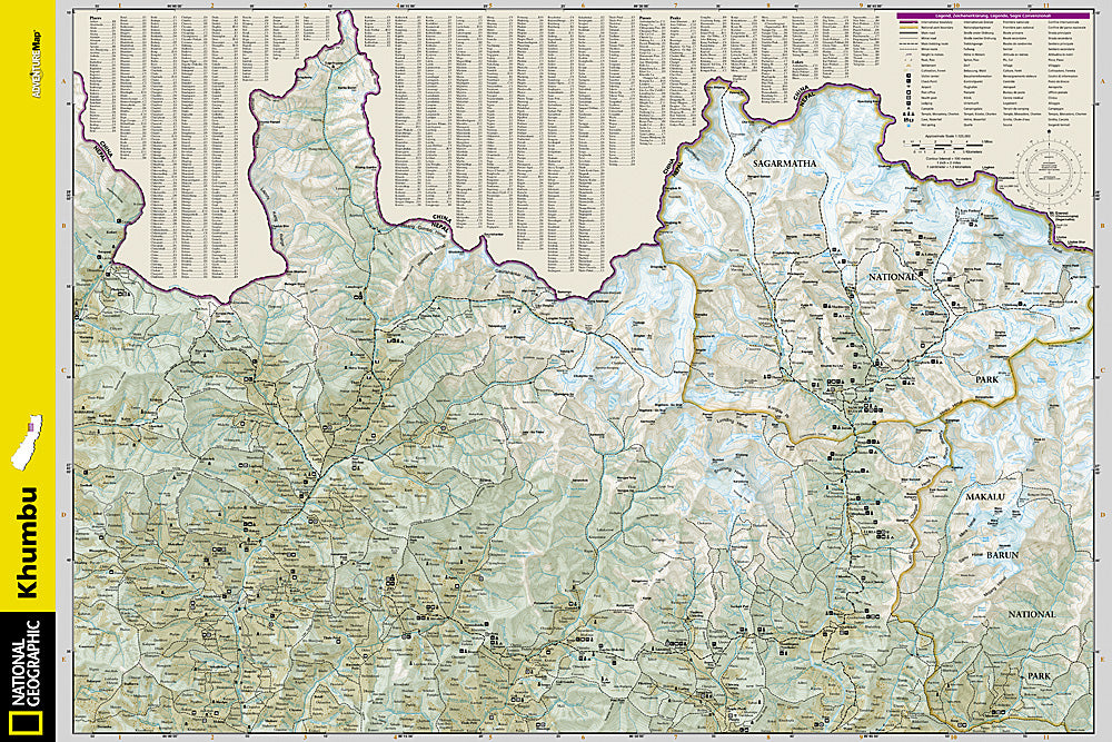
A detailed topographic and trekking map of the Khumbu region including Sagarmatha National Park and much of Makalu Barun National Park is shown on one side of the print map. Helpful travel aids such as visitor centers, checkpoints, lodging, religious sites, settlements, and post offices are clearly indicated. Maps of Nepal, Kathmandu, and its commercial neighborhood of Thamel are shown on the reverse side. In addition to restaurants, lodging, and shopping areas, a variety of resources are indicated on these inset maps as well including embassies/consulates, international organizations, places of worship, hospitals, banks, police stations, bus stops, and more.
Every Adventure Map is printed on durable synthetic paper, making them waterproof, tear-resistant and tough — capable of withstanding the rigors of international travel. Each is two-sided and can be folded to a packable size of (4.25" x 9.25"); unfolded size is (26" x 38").
Features:
- Waterproof and tear-resistant
- Accurate topography/terrain with a clearly labeled road network
- Hundreds of points of interest, including the locations parks and nature reserves, protected lands, historical and cultural attractions
- Thousands of place names including towns and natural features; detailed place names index
- Important travel networks including airports, lighthouses, ferry routes and rail lines
- Updated regularly to ensure accuracy
TIP: For lower prices on our maps, check out our promotions (click the link above the picture). Here is the info: Purchase 2 - 3 maps and get 10% off, 4 or more will get you 15% off! This promo includes ALL of our maps. For example, purchase 2 Trails Illustrated maps, 1 Destination map, and 1 Adventure map (total of 4) and get 15% off!! Just put everything in your shopping cart and you will see the savings!
Retail packaging, shipped in a poly envelope. Shipping weight 4 oz.
If you have any questions or concerns, please contact us before or after the sale - we want you to be a happy customer!
Thanks for looking!