National Geographic
National Geographic Adventure Map Nepal AD00003000
National Geographic Adventure Map Nepal AD00003000
Couldn't load pickup availability
National Geographic Adventure Map Nepal AD00003000
• Waterproof • Tear-Resistant • Travel Map
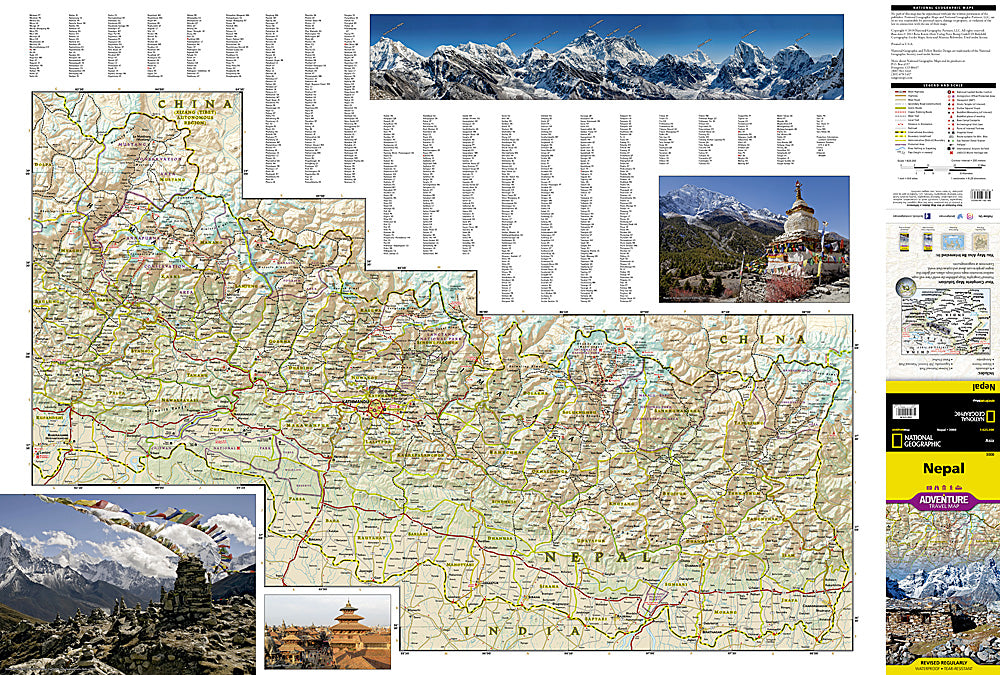
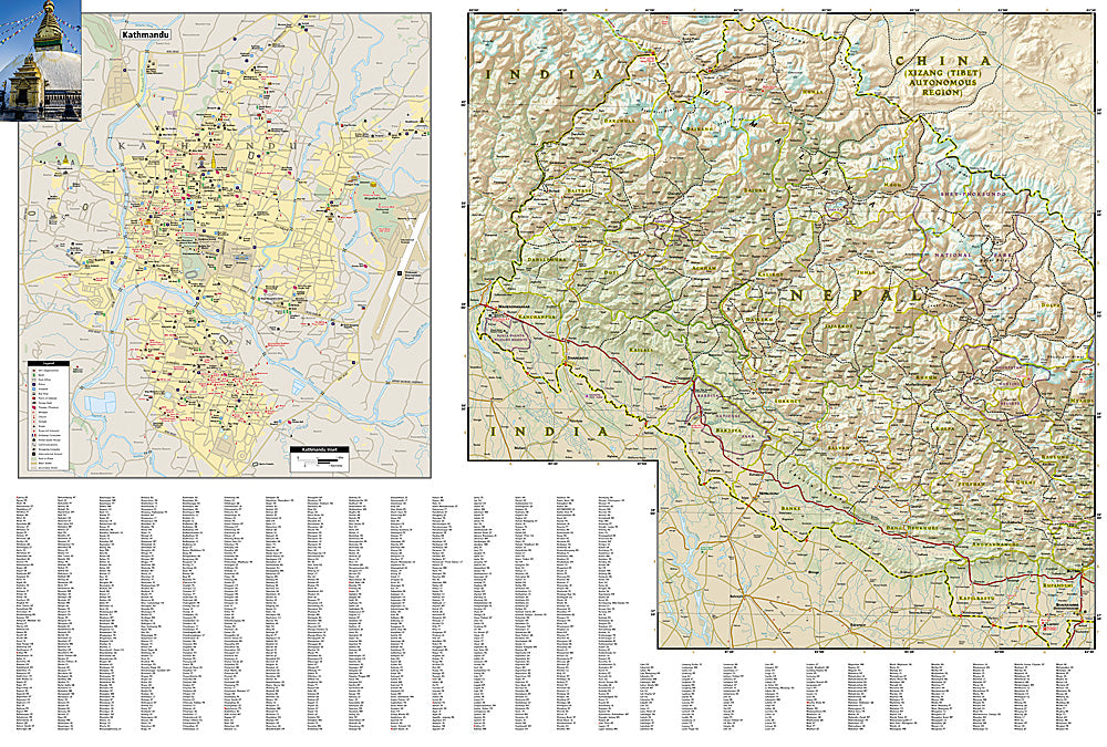
Explore the mystical reaches of the highest points on Earth with National Geographic's Nepal Adventure Map. This expertly crafted map includes the locations of thousands of cities and towns with an index for easily locating them, plus a clearly marked road network complete with distances and designations for highways, major roadways, secondary roads, scenic routes, and more. Classic trekking routes, main trails, and local trails are marked as well as areas for river rafting/kayaking and mountain biking. Hundreds of points of interest and diverse and unique destinations are highlighted including World Heritage sites, archeological sites, temples, monasteries, campsites, and more.
The front side of the print map offers a detailed topographic and trekking map of central and eastern Nepal, including border regions with China and India. Mountaineers will stay on course with marked trails through the Himalayan Range, including Everest (the tallest mountain in the world), and the surrounding national parks and wildlife reserves. An inset of the Himalayas has been annotated to show elevation. The backside includes the western portion of Nepal, from the city of Mahendranagar in the west, to the Shey-Phoksundo National Park and Dhorpatan Hunting Reserve in the east. A detailed inset of Kathmandu and Patan City provide valuable locations of goods and services for casual tourists and seasoned trekkers alike.
Every Adventure Map is printed on durable synthetic paper, making them waterproof, tear-resistant and tough — capable of withstanding the rigors of international travel. Each is two-sided and can be folded to a packable size of (4.25" x 9.25"); unfolded size is (26" x 38").
Features:
- Waterproof and tear-resistant
- Accurate topography/terrain with a clearly labeled road network
- Hundreds of points of interest, including the locations parks and nature reserves, protected lands, historical and cultural attractions
- Thousands of place names including towns and natural features; detailed place names index
- Important travel networks including airports, lighthouses, ferry routes and rail lines
- Updated regularly to ensure accuracy
TIP: For lower prices on our maps, check out our promotions (click the link above the picture). Here is the info: Purchase 2 - 3 maps and get 10% off, 4 or more will get you 15% off! This promo includes ALL of our maps. For example, purchase 2 Trails Illustrated maps, 1 Destination map, and 1 Adventure map (total of 4) and get 15% off!! Just put everything in your shopping cart and you will see the savings!
Retail packaging, shipped in a poly envelope. Shipping weight 4 oz.
If you have any questions or concerns, please contact us before or after the sale - we want you to be a happy customer!
Thanks for looking!