National Geographic
National Geographic Adventure Map Argentina South America AD00003400
National Geographic Adventure Map Argentina South America AD00003400
Couldn't load pickup availability
BRAND NEW National Geographic Argentina South America Adventure Travel Map.
• Waterproof • Tear-Resistant • Travel Map
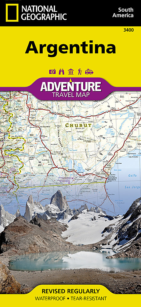
National Geographic's Adventure Map of Argentina is an invaluable tool for travelers seeking to explore the diverse landscapes, rich history, and stately architecture of South America's second largest nation. This expertly crafted map provides global travelers with the perfect combination of detail and perspective, highlighting hundreds of points of interest including archaeological sites, camping areas, museums, beaches, protected areas, World Heritage sites, and more. Cities and towns are clearly indicated and easy to find in the user-friendly index. A road network complete with distances and designations for highways, major routes, roads, unpaved tracks, and more will help you find the route that's right for you.
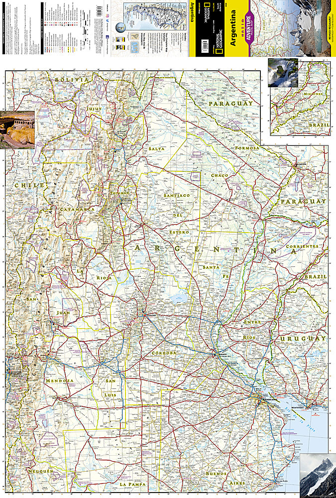
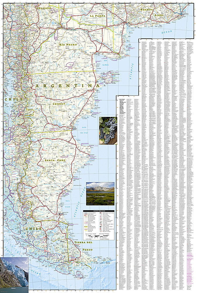
The north side of the print map details the most highly populated areas of the country including the provinces of Buenos Aires, Córdoba, and Santa Fe, as well as the impressive landscape of the Cordillera de los Andes bordering Chile on the northwest. Vineyards in Mendoza, Argentina's world-renowned wine producing province are included, as are ski areas in this popular tourist region. An inset map shows the small province of Misiones that juts into the neighboring countries of Brazil and Paraguay. The south side of the map details Argentina's extensive coastline from Mar Del Plata to Tierra Del Fuego highlighting beaches, preserves, and areas noted for fishing and surfing.
Every Adventure Map is printed on durable synthetic paper, making them waterproof, tear-resistant and tough — capable of withstanding the rigors of international travel.
Features:
- Waterproof and tear-resistant
- Accurate topography/terrain with a clearly labeled road network
- Hundreds of points of interest, including the locations parks and nature reserves, protected lands, historical and cultural attractions
- Thousands of place names including towns and natural features; detailed place names index
- Important travel networks including airports, lighthouses, ferry routes and rail lines
- Updated regularly to ensure accuracy
- Scale: 1:2,300,000
- Folded Size: 4.25" x 9.25"
- Flat Size: 25.5" x 37.75"
- Weight: Approx. 3.4 oz
TIP: For lower prices on our maps, check out our promotions (click the link above the picture). Here is the info: Purchase 2 - 3 maps and get 10% off, 4 or more will get you 15% off! This promo includes ALL of our maps. For example, purchase 2 Trails Illustrated maps, 1 Destination map, and 1 Adventure map (total of 4) and get 15% off!! Just put everything in your shopping cart and you will see the savings!
Requirements: None.
You will receive: 1 National Geographic Adventure Travel Map.
OEM packaging, shipped in a poly envelope. Shipping weight 4 oz.
If you have any questions or concerns, please contact us before or after the sale - we want you to be a happy customer!
Thanks for looking!