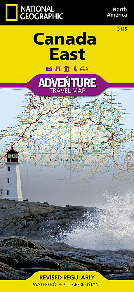
National Geographic
National Geographic Adventure Map Canada East AD00003115
National Geographic Adventure Map Canada East AD00003115
Couldn't load pickup availability
National Geographic Trails Illustrated Canada East Adventure Travel Map 3115.
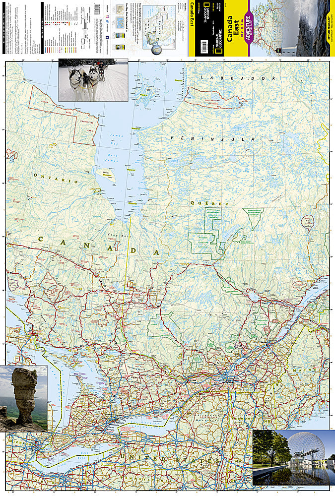
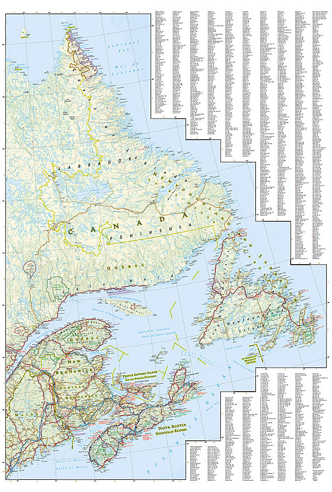
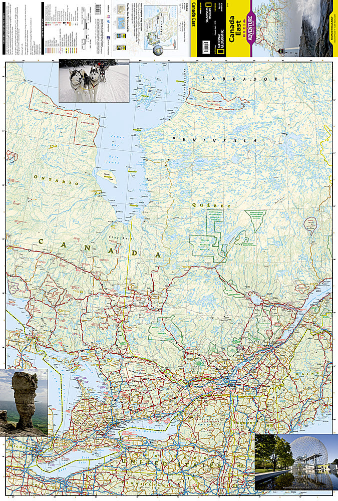
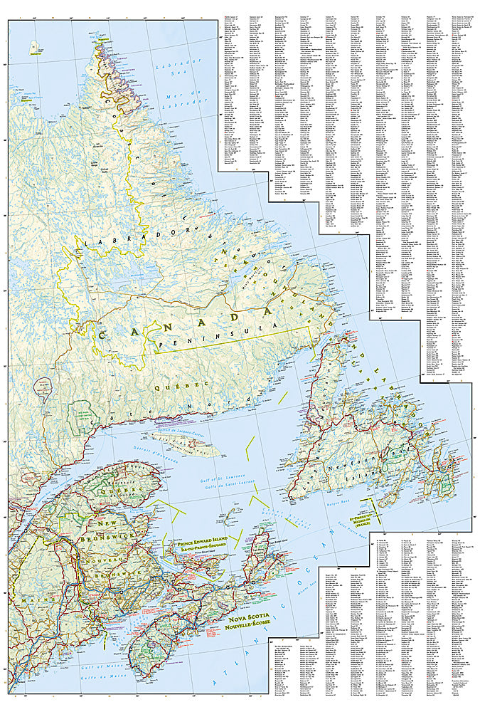
National Geographic's Canada East AdventureMap is designed to meet the needs of adventure travelers with its durability and detailed, accurate information. The map includes the locations of cities and towns with a user-friendly index, a clearly marked road network complete with distances and designations for roads/highways, plus secondary routes for those seeking to explore the stark wilderness of Newfoundland, the fertile farms of Prince Edward Island, or Nova Scotia's hidden coves and beaches.
AdventureMaps differ from a traditional road map because of the specialty content they include. Each map contains hundreds of diverse and unique recreational, ecological, cultural, and historic destinations -- outside of the major tourist hubs. Whether you seek the quaint harbor gem of Halifax, the majestic city life of Toronto, or the old world charm of Montreal and Quebec City, National Geographic AdventureMaps are the perfect companion to a guidebook, yet far easier to pack!
On the front side you'll find routes leading to the stunning Niagara Falls, Canada's largest city of Toronto, Algonquin Provincial Park (Canada's largest national park), and the northern regions of Ontario and the Labrador Peninsula. The far eastern provinces on the backside are playgrounds for active exploring and scenic beauty, including Quebec, New Brunswick, Prince Edward Island, Nova Scotia, Newfoundland, and the mighty St. Lawrence River.
The Canada East AdventureMap is printed in the United States on a durable synthetic paper, making it waterproof, tear-resistant, and capable of withstanding the rigors of international travel. The map is two-sided and is folded to a packable size of (4.25" x 9.25"); unfolded size is (26" x 38"). Travel Tip! Due to the synthetic sheet that AdventureMaps are printed on, you can easily fold the map to a discreet size, showing just the area you're interested in.
Features:
- Waterproof and tear-resistant
- Designed and printed in the U.S.A.
- Detailed topography with clearly labeled natural features
- Major road networks
- Hundreds of points of interest, including the location of nature reserves and national parks
- Thousands of place names with a detailed index Important travel aids including airports, rail lines, and other infrastructure
- Latitude/Longitude and UTM grids along with a compass rose and scale bars for accurate navigation with compass or GPS
- Approximately 4 1/4" x 9 1/4" folded; 25 1/2" x 37 3/4" fully opened
- Scale = 1:2,100,000
- Waterproof, tear-resistant
TIP: For lower prices on our maps, check out our promotions (click the link above the picture). Here is the info: Purchase 2 - 3 maps and get 10% off, 4 or more will get you 15% off! This promo includes ALL of our maps. For example, purchase 2 Trails Illustrated maps, 1 Destination map, and 1 Adventure map (total of 4) and get 15% off!! Just put everything in your shopping cart and you will see the savings!
Requirements: None.
You will receive: 1 National Geographic Adventure Travel Map.
OEM packaging, shipped in a poly envelope. Shipping weight 4 oz.
If you have any questions or concerns, please contact us before or after the sale - we want you to be a happy customer!
Thanks for looking!