National Geographic Maps
National Geographic City Destination Map Vancouver Canada DC01020312
National Geographic City Destination Map Vancouver Canada DC01020312
Couldn't load pickup availability
National Geographic City Destination Map Vancouver Canada DC01020312
National Geographic's City Destination map of Vancouver is both a comprehensive map and travel guide for this extraordinarily beautiful city. A regional map, insets of Victoria and Granville Island, and information about the city, points of interest, Stanley Park, and Victoria and Vancouver Island are featured on the front side of the map. Individual maps of the Translink System and Vancouver International Airport will help you navigate the transit terminals to more quickly and efficiently access your desired destinations.
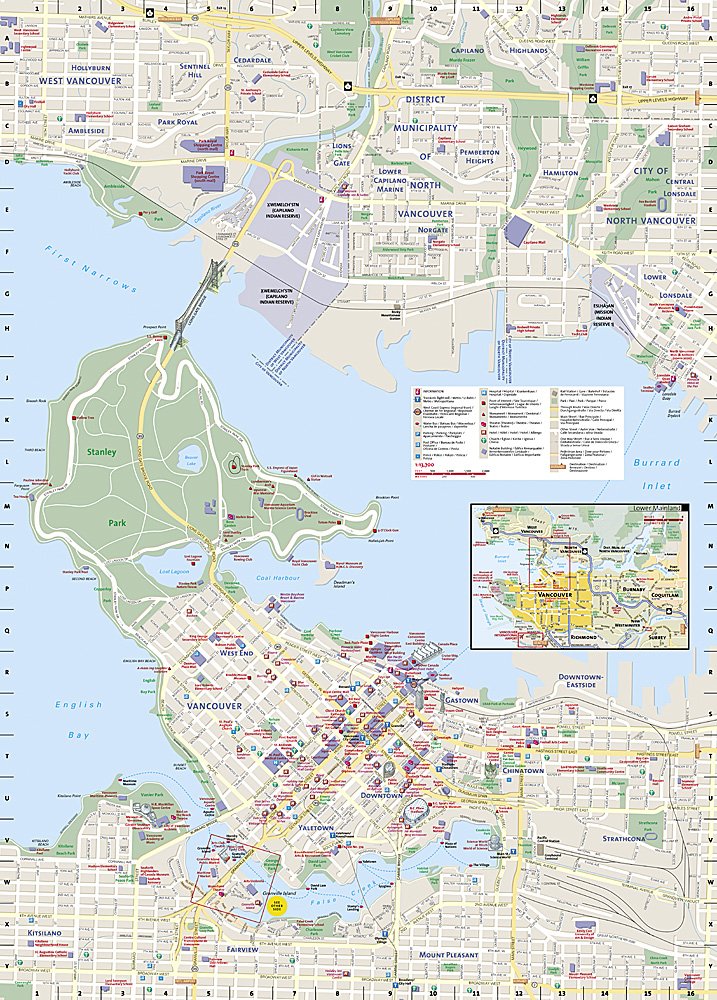
A detailed street map of the city is shown on the reverse side, complete with an inset map of the Lower Mainland. Points of interest, theaters, monuments, hotels, churches, parks, visitor information centers, and pedestrian areas are clearly marked and easy to find with the multi-language legend. The location of SkyTrain (light rail), West Coast Express (regional train), and Seabus stations, as well as parking areas are particularly useful in exploring Vancouver and its environs.
Every Destination Map is printed on durable synthetic paper, making them waterproof, tear-resistant and tough capable of withstanding the rigors of any kind of travel.
Features:
- Double-sided map containing detailed maps and useful travel information
- Maps include a comprehensive road network, local infrastructure, and abundant natural, historical, and cultural places
- Beautiful photographs and valuable travel information aids travelers with pre-trip planning and on-the-ground adventures
- Printed on a durable, waterproof, tear-resistant material
- Lightweight, packable, and folded to fit easily in your pocket
- 4 1/4 x 9 1/4" folded; 26 x 28" opened
- Scale = 1:400,000
TIP:For lower prices on our maps, check out our promotions (click the link above the picture). Here is the info: Purchase 2 - 3 maps and get 10% off, 4 or more willget you 15% off! This promo includes ALL of our maps. For example, purchase 2 Trails Illustrated maps, 1 Destination map, and 1 Adventure map (total of 4) and get15% off!! Just put everything in your shopping cart and you will see the savings!
Requirements: None.
You will receive: 1National GeographicTrails Illustrated Map.
Retailpackaging, shipped in a poly envelope. Shipping weight 4 oz.
If you have any questions or concerns, please contact us before or after the sale - we want you to be a happy customer!
Thanks for looking!
Listing and template services provided by inkFrog
![]()