National Geographic
National Geographic Adventure Map Corsica Island France Europe AD00003315
National Geographic Adventure Map Corsica Island France Europe AD00003315
Couldn't load pickup availability
BRAND NEW National Geographic Corsica Island France Europe Adventure Travel Map.
• Waterproof • Tear-Resistant • Travel & Road Map
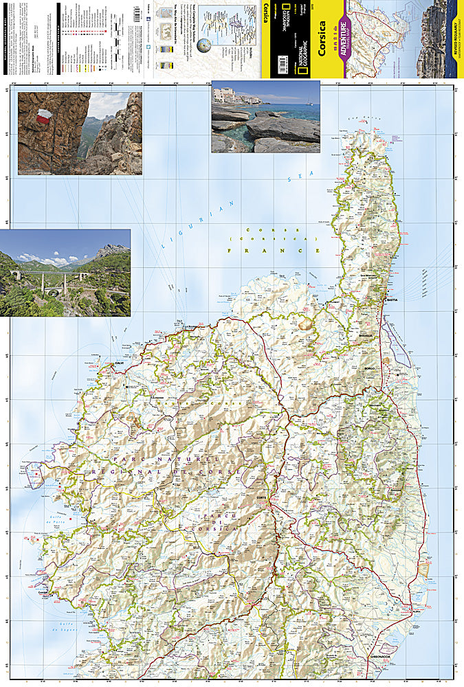
Explore the most mountainous island in the Mediterranean and discover why it's called the "isle of beauty" with National Geographic's Corsica Adventure Map. Cities and towns are clearly indicated and easy to find in the user-friendly index. A road network complete with distances and designations for major roads, expressways, scenic routes, and secondary roads will help you find the route that's right for you. The popular GR 20 trail is noted for advanced hikers looking to traverse one of the most beautiful mountain trails in Europe.
With specialty content to include hundreds of diverse and unique recreational, ecological, cultural, and historical destinations, this map is a perfect companion to a guidebook. Beaches, winter sports resorts, golf courses, spas, castles, churches, camping areas, and UNESCO World Heritage sites are clearly indicated so travelers can take advantage of Corsica's many natural attractions and activities. The locations of airports, airfields, harbors, marinas, and ferry routes take the guesswork out of travel around the island.
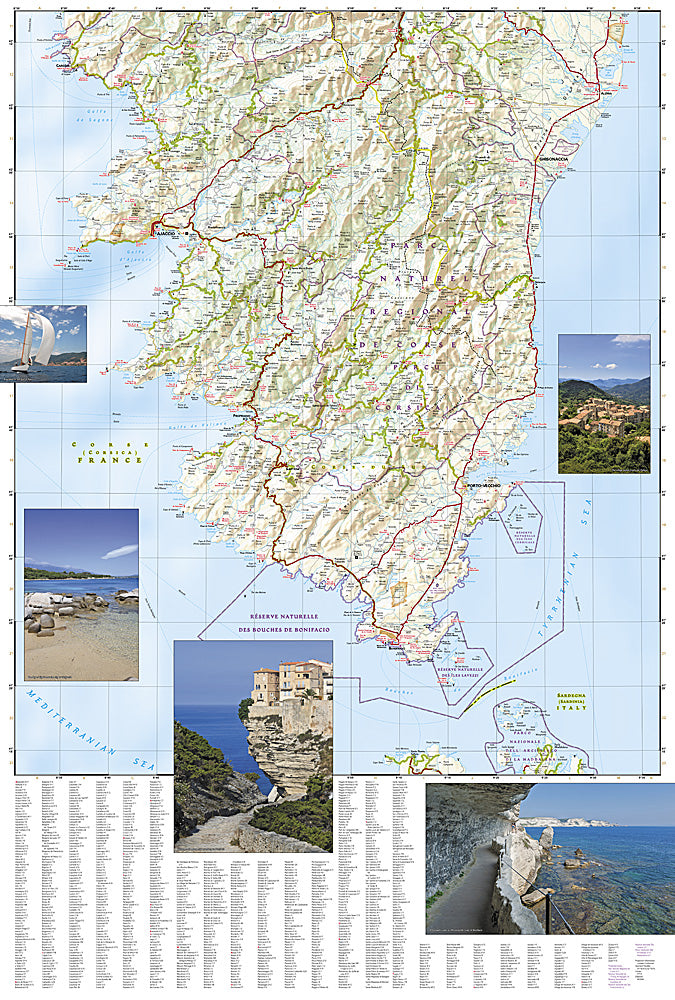
The front side of the print map details the northern region of this island country; bordering Golfe de Sagone and Golfe de Porto to the west, Tyrrhenian Sea to the east, and the Ligurian Sea and Golfe de St.-Florent to the north. The reverse side of the map shows the southern region; from its border with the Bouches de Bonifacio to the south, to the Tyrrhenian Sea, Golfe de Santa-Manza and Golfe de Porto-Vecchio to the east, and the Mediterranean Sea, Golfe de Sagone, Golfe de Valinco and Golfe d' Ajaccio to the west. This island is located west of Italy, southeast of the French mainland and north of the Italian island of Sardinia.
Every Adventure Map is printed on durable synthetic paper, making them waterproof, tear-resistant and tough — capable of withstanding the rigors of international travel.
Features:
- Waterproof and tear-resistant
- Easy to find cities and towns
- Roads are clearly marked with distance in kilometers
- Hundreds of recreational, historical, and cultural destinations are clearly marked
- Updated regularly to ensure accuracy
- Scale: 1:150,000
- Folded Size: 4.25" x 9.25"
- Flat Size: 25.5" x 37.75"
- Weight: Approx. 3.4 oz
TIP: For lower prices on our maps, check out our promotions (click the link above the picture). Here is the info: Purchase 2 - 3 maps and get 10% off, 4 or more will get you 15% off! This promo includes ALL of our maps. For example, purchase 2 Trails Illustrated maps, 1 Destination map, and 1 Adventure map (total of 4) and get 15% off!! Just put everything in your shopping cart and you will see the savings!
Requirements: None.
You will receive: 1 National Geographic Adventure Travel Map.
OEM packaging, shipped in a poly envelope. Shipping weight 4 oz.
If you have any questions or concerns, please contact us before or after the sale - we want you to be a happy customer!
Thanks for looking!