National Geographic Maps
Yellowstone Nat Park Map & Day Hikes Bundle TI01021225B
Yellowstone Nat Park Map & Day Hikes Bundle TI01021225B
Couldn't load pickup availability
BRAND NEW National Geographic Trails Illustrated WY Yellowstone National Park Map & Day Hikes Topographic Map Guide Bundle Pack.
• Waterproof • Tear-Resistant • Topographic Map & Guide
Yellowstone is the wild heart of America! Established in 1872, it’s our first National Park and the birthplace of the National Park idea. Its 2.2 million acres contain the world’s largest, most varied collection of hydrothermal features and provide sanctuary for many rare and exquisite animals.
This two title Map Pack Bundle helps explorers of all levels see everything this astounding park has to offer. The map pack includes an overview map that shows the entire park as well as a Day Hikes map guide. With this combination of maps visitors can feel comfortable planning a trip to a park with options for everyone, from multi-day backpack trips to short hikes near Old Faithful.
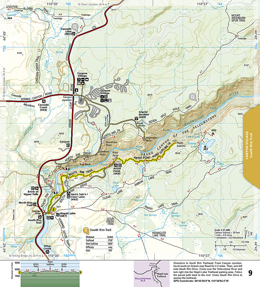
The Yellowstone National Park Day Hikes Topographic Map Guide contains detailed maps for 18 of Yellowstone’s finest day hikes, scattered across 6 regions of the park. It includes well-known hikes, together with a few off-the-beaten-path trails, selected to give you a wonderful sampling of all the park has to offer. Together, they cover more than 100 miles of adventures. One-third of the selected hikes are less than 5 miles long, two-third are less than 8 miles, and only one hike is longer than 10 miles.
Buy the Map Pack and save 15%!
The Yellowstone National Park and Day Hikes Map Pack includes:
Map 201 :: Yellowstone National Park
Map 1705 :: Yellowstone National Park Day Hikes
Every Trails Illustrated map is printed on 'Backcountry Tough' waterproof, tear-resistant paper. National Geographic's Topographic Map Guide booklets are printed on 'Backcountry Tough' waterproof, tear-resistant paper with stainless steel staples. A full UTM grid is printed on the map to aid with GPS navigation.
Features:
- Accurate topography/terrain with clearly labeled details
- Full UTM grid for GPS use
- Each page provides statistics like mileages, elevations, & trailheads
- Detailed trail profile on each page
- Detailed topographic maps
- Booklet format - more convenient and easier to use than folded maps
- Waterproof and tear-resistant paper with stainless steel staples
- Model: TI01021225B
- Scale: 1:126,720 and 1:50,000
- Size: 4.25" x 9.38"
- Weight: Approx. 6.5 oz
Retail packaging, shipped in a poly envelope. Shipping weight 8 oz.
If you have any questions or concerns, please contact us before or after the sale - we want you to be a happy customer!
Thanks for looking!