Trails Illustrated
National Geographic TI Appalachian Trail NJ NY CT MA Topo Map Guide Bundle Pack TI01021222B
National Geographic TI Appalachian Trail NJ NY CT MA Topo Map Guide Bundle Pack TI01021222B
Couldn't load pickup availability
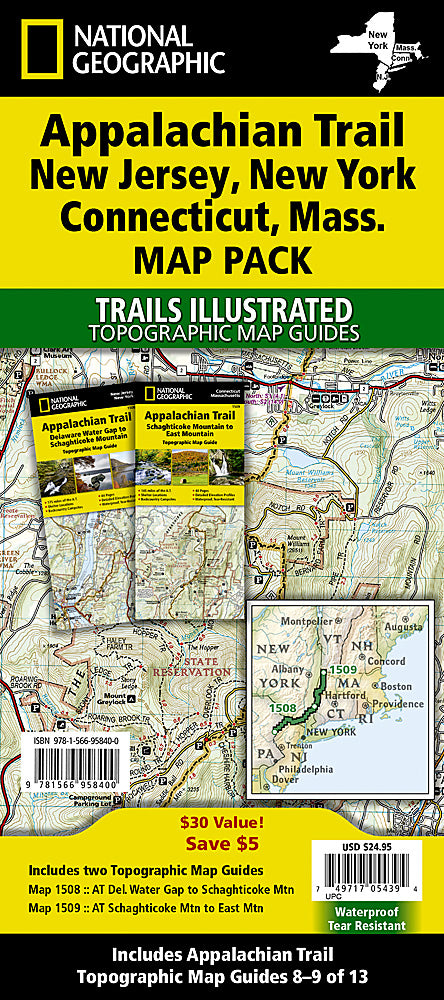
BRAND NEW National Geographic Trails Illustrated Appalachian Trail NJ NY CT MA Topographic Map Guide Bundle Pack.
• Waterproof • Tear-Resistant • Topographic Map Guides
The Appalachian Trail (AT) Map Pack Bundle of New Jersey, New York, Connecticut, Massachusetts includes two Topographic Map Guides that cover the AT from the Pennsylvania border in the south to the Vermont state line in the north. The trail through New Jersey and New York is surprisingly rugged, and much more remote than one would imagine given its proximity to large population centers. As the trail leaves New York it skirts the northwest corner of Connecticut and traverses what remains of a once mighty mountain range. The hiking is moderate through Connecticut and the climbs are short, but can be steep. As the trail crosses into Massachusetts, it enters the Berkshires, characteristic of wooded hills, outstanding views with pleasant, flat hiking along the Berkshire plateau.
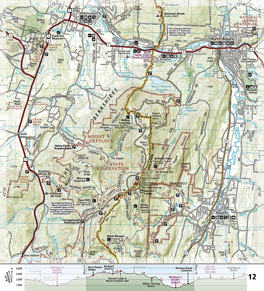
Each AT Topographic Map Guide includes detailed topographic maps at a detail of 1 inch = 1 mile. Each page is centered on the A.T. and overlaps with the adjacent pages so there is little chance of getting lost. Along the bottom of each page is a trail profile that shows the distance between shelters, camping areas, and trail access points. The map and trail profile provide a step by step visual guide to hiking the trail, mile by rugged mile. The Topographic Map Guide is built for all levels of hiking enthusiasts, from the day tripper to the multi month 'thru-hiker'. The front pages of the printed Topographic Map Guide include resupply information, town inset maps, camping options, and much more.
Buy the Map Pack and save over 15%!
The Appalachian Trail: New Jersey, New York, Connecticut, Massachusetts [Map Pack Bundle] includes:
Map 1508 :: Delaware Water Gap to Schaghticoke Mountain [New Jersey, New York]
Map 1509 :: Schaghticoke Mountain to East Mountain [Connecticut, Massachusetts]
More convenient and easier to use than folded maps, but just as compact and lightweight, National Geographic's Topographic Map Guide booklets are printed on "Backcountry Tough" waterproof, tear-resistant paper with stainless steel staples. A full UTM grid is printed on the map to aid with GPS navigation.
Features:
- Accurate topography/terrain with clearly labeled details
- Full UTM grid for GPS use
- Each page provides statistics like mileages, elevations, & trailheads
- Detailed trail profile on each page
- Detailed topographic maps
- Booklet format - more convenient and easier to use than folded maps
- Waterproof and tear-resistant paper with stainless steel staples
- Scale: 1:63,360
- Size: 4.25" x 9.38"
- Weight: Approx. 6.5 oz
TIP: For lower prices on our maps, check out our promotions (click the link above the picture). Here is the info: Purchase 2 - 3 maps and get 10% off, 4 or more will get you 15% off! This promo includes ALL of our maps. For example, purchase 2 Trails Illustrated maps, 1 Destination map, and 1 Adventure map (total of 4) and get 15% off!! Just put everything in your shopping cart and you will see the savings!
Requirements: None.
You will receive: 1 National Geographic Topographic Map Guide Bundle Pack.
Retail packaging, shipped in a poly envelope. Shipping weight 8 oz.
If you have any questions or concerns, please contact us before or after the sale - we want you to be a happy customer!
Thanks for looking!