

NA
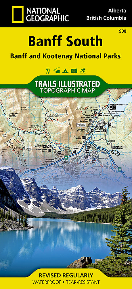
National Geographic Trails Illustrated Alberta/BC Canada Banff South Map TI00000900
National Geographic Trails Illustrated Alberta/BC Canada Banff South Map TI00000900
Couldn't load pickup availability
BRAND NEW National Geographic Trails Illustrated Alberta/British Columbia Canada Banff SouthTrail Topo Map 900.
Great for Camping, Fishing, Hunting, Hiking, Backpacking, Family Outings, Outdoor Adventure.
More than just a map, National Geographic Trails Illustrated topographic maps are designed to take you into the wilderness and back. Printed on tear-resistant, waterproof material, this map can go anywhere you do. Each map is based on exact reproductions of USGS topographic map information, updated, customized, and enhanced to meet the unique features of each area. The maps include valuable wilderness tips and Leave No Trace guidelines, along with updated trails, trailheads, points of interest, campgrounds, and much more. With a new color palette and stunning shaded relief, backcountry navigation has never been easier.
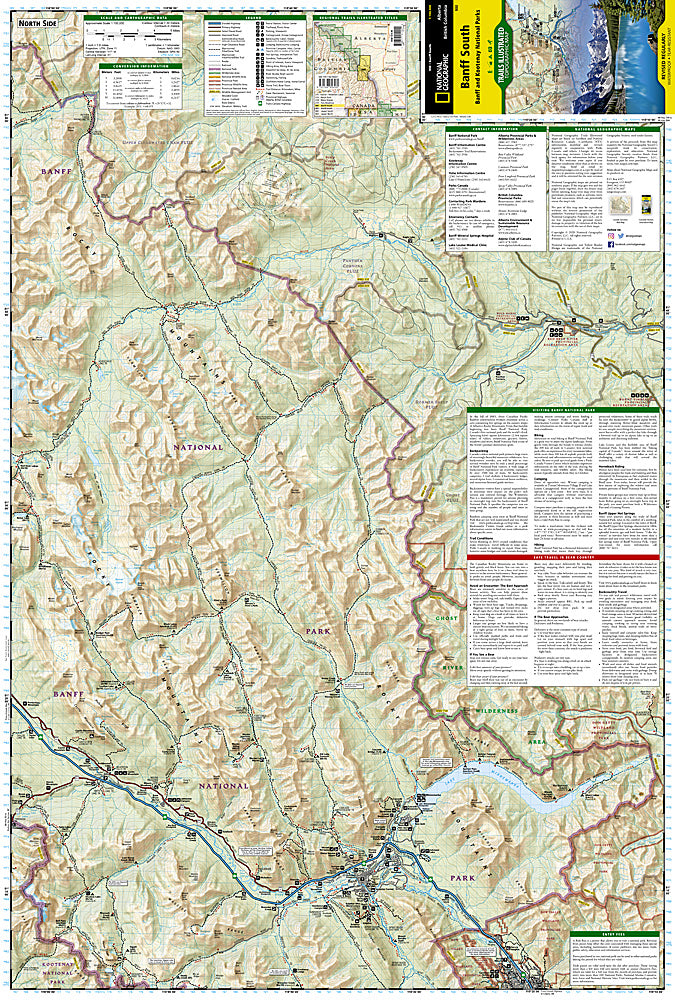
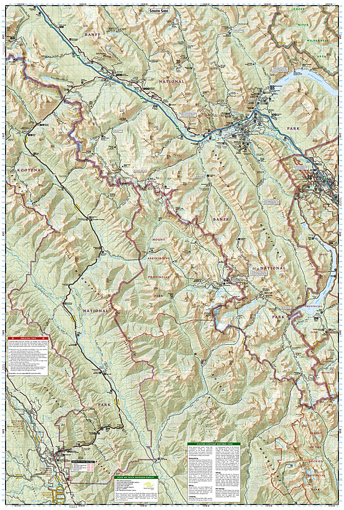
National Geographic's Trails Illustrated map of Banff South is a two-sided, waterproof map designed to meet the needs of outdoor enthusiasts with unmatched durability and detail. This map was created in conjunction with local land management agencies and is loaded with valuable recreation information.
The front side of the Banff South map details the north side of the national park, from Scalp Creek Natural Area to the north, to Bow Valley Wildland Provincial Park to the south. This side also covers survival tips, entry fees and what to do while visiting. The reverse side of the map details the south side of the park, extending from Height of the Rockies Provincial Park to the south, to Ghost River Wilderness Area to the North. Insets show tips on outdoor ethics, and activities while visiting Kootenay National Park such as backpacking, camping, biking, hiking and the hot springs. Trails Illustrated maps are expertly researched and frequently updated. The maps are printed in the United States on durable synthetic paper, making them waterproof, tear-resistant, and trail tough—capable of going anywhere you do.
Product Features:
- Approximately 4.25" x 9.25" folded; 26" x 38" fully opened
- Scale = 1:80,000 & 1:31,680
- Waterproof, tear-resistant
TIP 1: For lower prices on our maps, check out our promotions (click the link above the picture). Here is the info: Purchase 2 - 3 maps and get 10% off, 4 or more will get you 15% off! This promo includes ALL of our maps. For example, purchase 2 Trails Illustrated maps, 1 Destination map, and 1 Adventure map (total of 4) and get 15% off!! Just put everything in your shopping cart and you will see the savings!
TIP 2: We have a huge selection and great prices on our National Geographic maps! Click here to go to our store, click on the store category called Maps & Books, then browse our sub-categories, or use the Store search tool to find items quickly.
Requirements: None.
You will receive: 1 National Geographic Trails Illustrated Map.
Retail packaging, shipped in a poly envelope. Shipping weight 4 oz.
If you have any questions or concerns, please contact us before or after the sale - we want you to be a happy customer!
Thanks for looking!