National Geographic Maps
National Geographic Buffalo National River Map Pack Bundle TI01021273B
National Geographic Buffalo National River Map Pack Bundle TI01021273B
Couldn't load pickup availability
BRAND NEW National Geographic Trails Illustrated Arkansas Buffalo National River Topographic Map Pack Bundle.
• Waterproof • Tear-Resistant • Topographic Maps
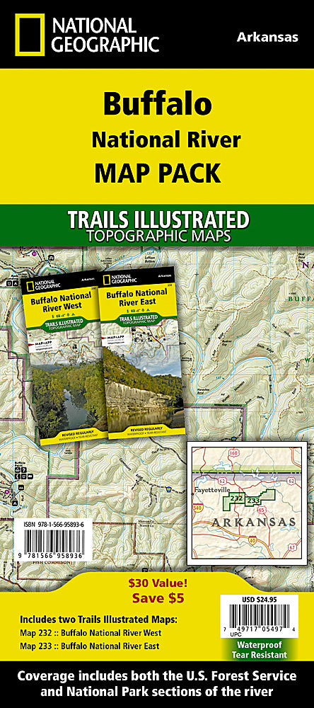
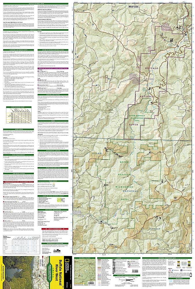
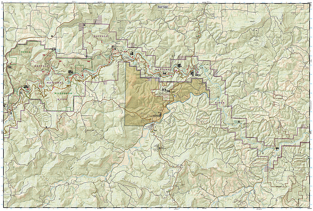
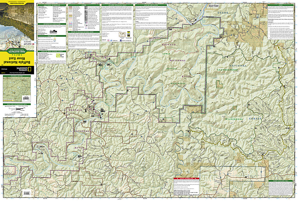
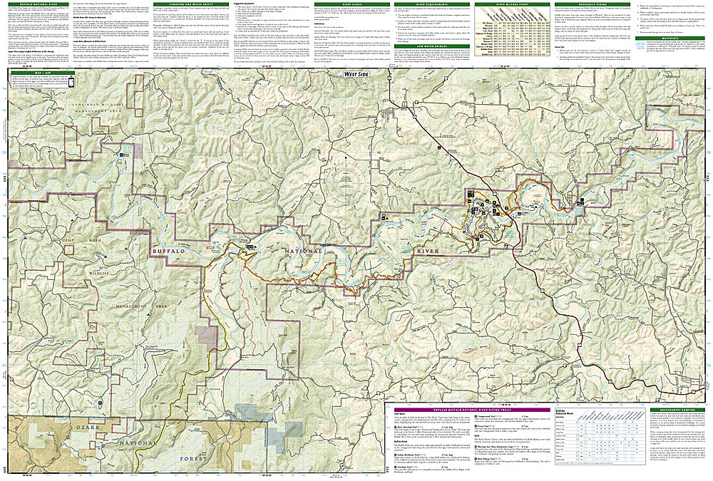
The first National River to be designated in the United States, the Buffalo River flows 153 miles through the tranquil forests and dramatic sandstone and limestone bluffs of the Ozarks. National Geographic's Trails Illustrated Map Pack Bundle of the Buffalo National River combines unmatched detail with helpful information to offer an invaluable tool for making the most of your visit to one of the few remaining undammed rivers in the lower 48 states. Created in partnership with local land management agencies, these expertly researched maps include sections of the river from the Upper Buffalo Wilderness and the Ozark National Forest, through Boxley Valley to the Little Buffalo River, then through to Woolum. Also included are the Lower Buffalo and Leatherwood Wilderness Areas, Gene Rush Wildlife Management Area and parts of Ozark National Forest
Summaries of popular hiking and horse trails will help you choose the route that's right for you. The clearly marked trails include mileages between intersections. Handy river mileage and services charts are included as well. The map bases include contour lines and elevations for summits and passes. Some of the many recreation features include interpretive trails, campgrounds, trailheads, river access, waterfalls, horse camps, and scenic areas. Information on caves, canoeing and water safety, recreational activities, and more will help guide you in exploring all the region has to offer.
Buy the Map Pack and save 15%!
The Buffalo National River Map Pack includes:
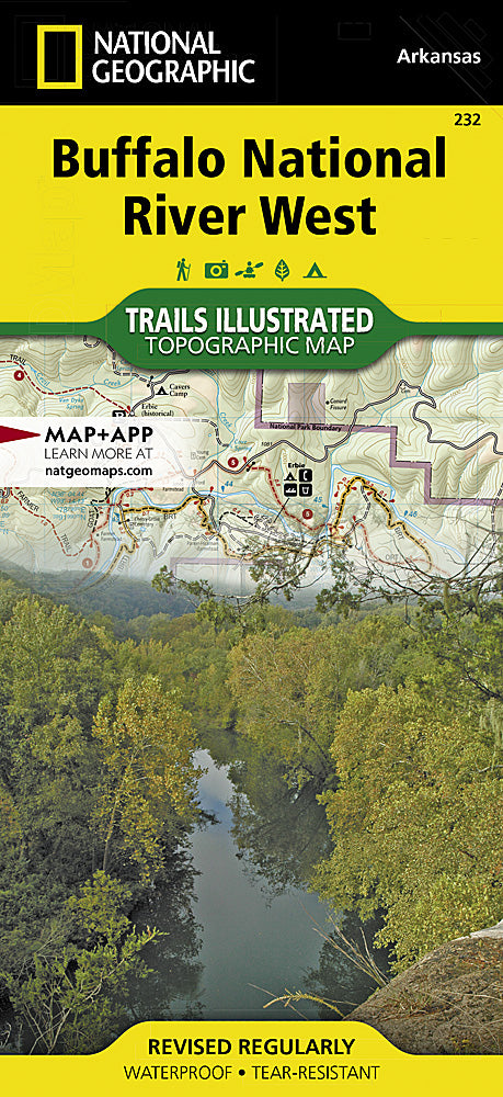
Map 232 :: Buffalo National River West
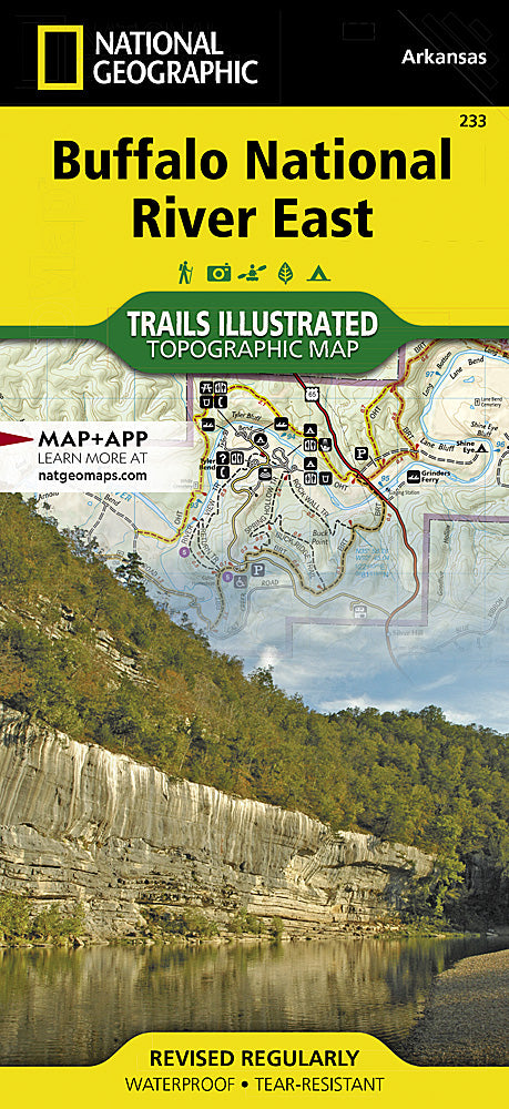
Map 233 :: Buffalo National River East
Every Trails Illustrated map is printed on "Backcountry Tough" waterproof, tear-resistant paper. A full UTM grid is printed on the map to aid with GPS navigation.
Features:
- Waterproof, tear-resistant paper
- Accurate topography/terrain with clearly labeled details
- Full UTM grid for GPS use
- Includes regulations, permit info, and safety tips
- Hiking trail and backcountry road guides
- Route descriptions and mileages
- Detailed topographic map with contour lines, elevations, and shaded relief
- Water features with river mileage
- Mountain bike routes with degree of difficulty
- Campgrounds and campsites, scenic overlooks, and boat launch sites
- Model: TI01021273B
- Scale: 1:70,000, 1:35,000
- Folded Size: 4.25" x 9.25"
- Flat Size: 25.5" x 37.75"
- Weight: Approx. 3.4 oz each map
TIP: For lower prices on our maps, check out our promotions (click the link above the picture). Here is the info: Purchase 2 - 3 maps and get 10% off, 4 or more will get you 15% off! This promo includes ALL of our maps. For example, purchase 2 Trails Illustrated maps, 1 Destination map, and 1 Adventure map (total of 4) and get 15% off!! Just put everything in your shopping cart and you will see the savings!
Retail packaging, shipped in a poly envelope. Shipping weight 8 oz.
If you have any questions or concerns, please contact us before or after the sale - we want you to be a happy customer!
Thanks for looking!