National Geographic Maps
National Geographic Eldorado Nat Forest Map Pack Bundle TI01021251B
National Geographic Eldorado Nat Forest Map Pack Bundle TI01021251B
Couldn't load pickup availability
BRAND NEW National Geographic Trails Illustrated California Nevada Eldorado National Forest Topographic Map Pack Bundle.
• Waterproof • Tear-Resistant • Topographic Maps
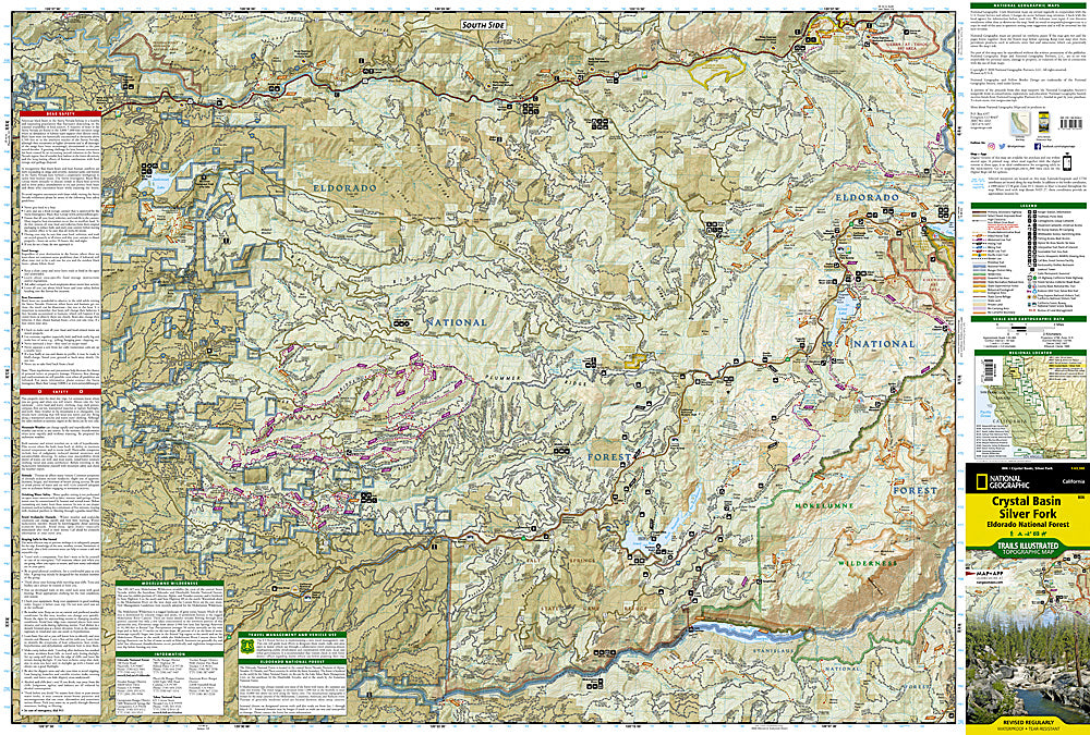
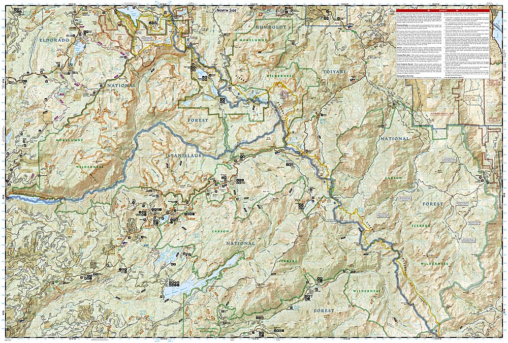
National Geographic's Trails Illustrated Map Pack Bundle of Eldorado National Forest covers a region that is an ideal place for people seeking to escape from busy urban lifestyles. Its climate and topography offer a wide range of recreational opportunities, including hiking, fishing, camping and cross-country and downhill skiing. The forest is located one hour from the metropolitan area of Sacramento, and two to three hours driving time from the San Francisco Bay area. The forest plays a vital role in the environment, health and well being of millions of people.
The area's many trails are clearly marked and color coded according to their designated usage, whether you're exploring on foot, horseback, bike, or motorized vehicle. Trail mileage between intersections along with contour lines and elevations will help you choose the path that's right for you. The Pacific Crest Trail bisects the area and is highlighted along with the California National Historic Trail, and Rubicon OHV Trail. Some of the many recreation features include: snowmobile trails, ski areas, sno-parks, fishing and boat access, campgrounds and RV camping, scenic viewpoints and wildlife viewing areas.
Buy the Map Pack and save over 15%!
The Eldorado National Forest Map Pack includes:
Map 803 :: Lake Tahoe Basin
Map 806 :: Crystal Basin, Silver Fork
Map 807 :: Carson-Iceberg, Emigrant, and Mokelumne Wilderness Areas
Every Trails Illustrated map is printed on "Backcountry Tough" waterproof, tear-resistant paper. A full UTM grid is printed on the map to aid with GPS navigation.
Features:
- Waterproof, tear-resistant paper
- Accurate topography/terrain with clearly labeled details
- Full UTM grid for GPS use
- Includes regulations, permit info, and safety tips
- Hiking trail and backcountry road guides
- Route descriptions and mileages
- Detailed topographic map with contour lines, elevations, and shaded relief
- Water features with river mileage
- Mountain bike routes with degree of difficulty
- Campgrounds and campsites, scenic overlooks, and boat launch sites
- Model: TI01021251B
- Scale: 1:63,360
- Folded Size: 4.25" x 9.25"
- Flat Size: 25.5" x 37.75"
- Weight: Approx. 3.4 oz each map
TIP: For lower prices on our maps, check out our promotions (click the link above the picture). Here is the info: Purchase 2 - 3 maps and get 10% off, 4 or more will get you 15% off! This promo includes ALL of our maps. For example, purchase 2 Trails Illustrated maps, 1 Destination map, and 1 Adventure map (total of 4) and get 15% off!! Just put everything in your shopping cart and you will see the savings!
Retail packaging, shipped in a poly envelope. Shipping weight 11 oz.
If you have any questions or concerns, please contact us before or after the sale - we want you to be a happy customer!
Thanks for looking!