
National Geographic
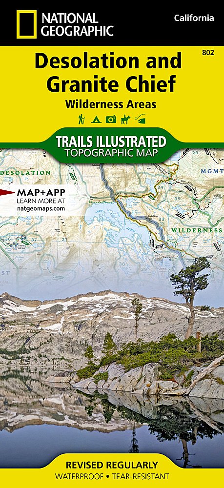
National Geographic Trails Illustrated Desolation & Granite Chief Wilderness Map TI00000802
National Geographic Trails Illustrated Desolation & Granite Chief Wilderness Map TI00000802
Couldn't load pickup availability
BRAND NEWNational Geographic Trails Illustrated CA Desolation & Granite Chief Wilderness AreasTopo Map802.
Waterproof Tear-Resistant Topographic Map
The two wilderness areas of Desolation and Granite Chief are tucked up against the west shore of Lake Tahoe in the Sierras of California. The land which became Desolation Wilderness was once part of the Lake Tahoe Forest Reserve, established in 1899. In 1910, when the first tourists were beginning to make their way over the narrow dirt roads of Echo and Donner summits, the area was made part of the newly-formed Eldorado National Forest. The area was named the Desolation Valley Primitive Area in 1931, and in 1969 Desolation Wilderness was Congressionally designated and included in the National Wilderness Preservation System. The Desolation Wilderness is 63,960 acres of subalpine forests, glacial lakes and valleys, and granite peaks.
The Granite Chief Wilderness was designated a Wilderness area in 1984 because of its pristine nature, natural beauty, and primitive, non-motorized recreational opportunities. This 25,680-acre wilderness offers beautiful valley meadows and spectacular 9,000-foot granite peaks. The headwaters of the American River are located in the wilderness, where elevations range from 5,000 feet to 9,000 feet.
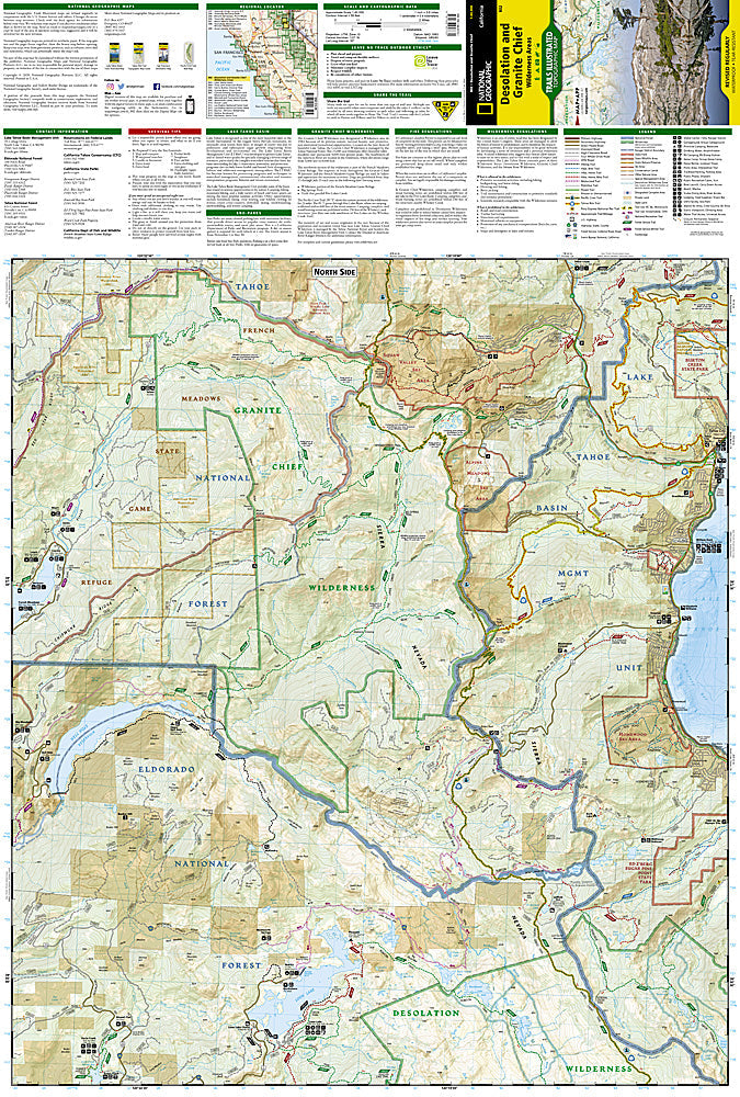
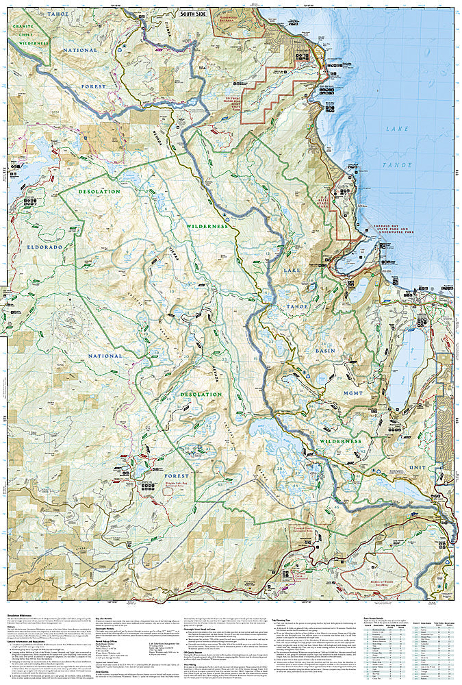
The printed map is arranged so route-finding within each wilderness area is as simple as possible with the entire Granite Chief Wilderness shown on the front side of the map and the Desolation Wilderness shown on the back. Despite their proximity of the shores of Lake Tahoe the two wilderness areas offer remote trails that make their way deep into the backcountry. Every trail is classed based on its use including hiking or equestrian, and each trail segment includes a distance so you know how far your travels will take you.
Every Trails Illustrated map is printed on "Backcountry Tough" waterproof, tear-resistant paper. A full UTM grid is printed on the map to aid with GPS navigation.
Features:
- Accurate topography/terrain with clearly labeled details
- Full UTM grid for GPS use
- Hundreds of points of interest, including the locations of parks and nature reserves, protected lands, historical and cultural attractions
- Thousands of place names including towns and natural features; detailed place names index
- Important travel networks including airports, lighthouses, ferry routes and rail lines
- Updated regularly to ensure accuracy
- Waterproof and tear-resistant paper
- Scale: 1:40,000
- Folded Size: 4.25" x 9.25"
- Flat Size:25.5" x 37.75"
- Weight: Approx. 3 oz
TIP: For lower prices on our maps, check out our promotions (click the link above the picture). Here is the info: Purchase 2 - 3 maps and get 10% off, 4 or more will get you 15% off! This promo includes ALL of our maps. For example, purchase 2 Trails Illustrated maps, 1 Destination map, and 1 Adventure map (total of 4) and get 15% off!! Just put everything in your shopping cart and you will see the savings!
Requirements: None.
You will receive: 1 National Geographic Topographic Map.
OEM packaging, shipped in a poly envelope. Shipping weight 4 oz.
If you have any questions or concerns, please contact us before or after the sale - we want you to be a happy customer!
Thanks for looking!