National Geographic
National Geographic GA / SC Chattahoochee Map Pack TI01020451B
National Geographic GA / SC Chattahoochee Map Pack TI01020451B
Couldn't load pickup availability
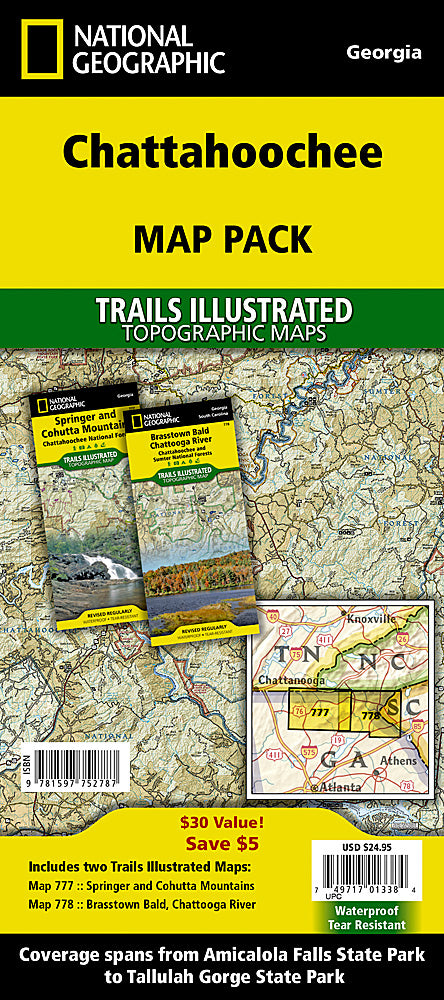
BRAND NEW National Geographic Trails Illustrated Georgia and South Carolina Chattahoochee Topo Map Bundle Pack includes maps 777 and 778. Great for Camping, Fishing, Hunting, Hiking, Backpacking, Family Outings, Outdoor Adventure.
More than just a map, National Geographic Trails Illustrated topographic maps are designed to take you into the wilderness and back. Printed on tear-resistant, waterproof material, this map can go anywhere you do. Each map is based on exact reproductions of USGS topographic map information, updated, customized, and enhanced to meet the unique features of each area. The maps include valuable wilderness tips and Leave No Trace guidelines, along with updated trails, trailheads, points of interest, campgrounds, and much more. With a new color palette and stunning shaded relief, backcountry navigation has never been easier.
This listing is for the Georgia and South Carolina Chattahoochee Map Bundle Pakc Topo Map 777 and 778.
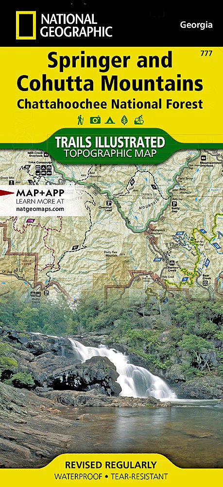
Map 777 Springer and Cohutta Mountains
This Trails Illustrated topographic map is the most comprehensive recreational map for the Springer & Cohutta Mountains section of the Chattahoochee National Forest. Located just north of Atlanta, the Chattahoochee National Forest contains the southern terminus of the Appalachian Trail along with an abundance of recreational opportunities for outdoor enthusiasts.
The west side of the map includes The Cohutta Wilderness, Cohutta Wildlife Management Area, Fort Mountain State Park, Rich Mountain Wildlife Management Area, Rich Mountain Wilderness, Coosawattee Wildlife Management Area, a segment of the Benton MacKaye Trail, and more.
The east side of the map includes Nottely Lake, Roundtop Mountain, Coopers Creek Wildlife Management Area, Vogel State Park, Raven Cliffs Wilderness, Chestatee Wildlife Management Area, Blood Mountain Wilderness, Ed Jenkins National Recreation Area, Blue Ridge Wildlife Management Area, Amicalola Falls State Park, Whissenhunt Mountain, and more.
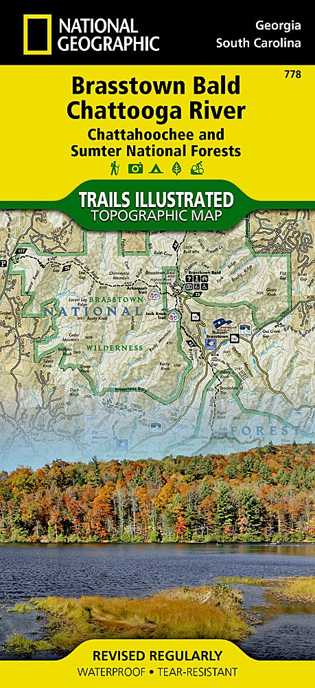
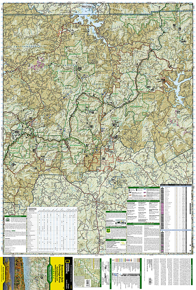
Map 778 Brasstown Bald and Chattooga River
Located just north of Atlanta, the Chattahoochee National Forest contains the southern terminus of the Appalachian Trail along with an abundance of recreational opportunities for outdoor enthusiasts of all interests. This map contains carefully researched trails, campsites, forest service roads, and points-of-interest. Useful UTM and Latitude/Longitude grids, mileage charts, and other navigation features make Brasstown Bald/Chattooga River the best map available for this section of the Chattahoochee National Forest.
- Approximately 4.25" x 9" folded; 25 1/2" x 37 3/4" fully opened
- Scale = 1:63,360
- Waterproof, tear-resistant
Requirements: None.
TIP: This item is also available in money-saving 2-packs and 3-packs! Go to our store, then browse our Discounted Multi-Packs Store category, or use the Store search tool to find items quickly.
You will receive: 1 National Geographic Trails Illustrated Map Pack.
Retail packaging, shipped in a poly envelope. Shipping weight 8 oz.
If you have any questions or concerns, please contact us before or after the sale - we want you to be a happy customer!
Thanks for looking!
Due to inclement weather, shipping may be delayed.
Listing and template services provided by inkFrog
![]()