National Geographic
National Geographic Trails Illustrated KY/TN Big South Fork Natl Area Map TI00000241
National Geographic Trails Illustrated KY/TN Big South Fork Natl Area Map TI00000241
Couldn't load pickup availability
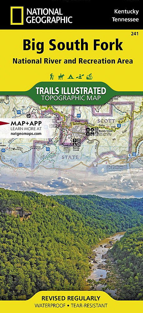
National GeographicTrails Illustrated Kentucky/TennesseeBig South Fork National Recreation Area Topo Map 241. Greatfor Camping, Fishing, Hunting,Hiking, Backpacking, Family Outings, Outdoor Adventure.
More than just a map, National Geographic Trails Illustrated topographic maps are designed to take you into the wilderness and back. Printed on tear-resistant, waterproof material, this map can go anywhere you do. Each map is based on exact reproductions of USGS topographic map information, updated, customized, and enhanced to meet the unique features of each area. The maps include valuable wilderness tips and Leave No Trace guidelines, along with updated trails, trailheads, points of interest, campgrounds, and much more. With a new color palette and stunning shaded relief, backcountry navigation has never been easier.
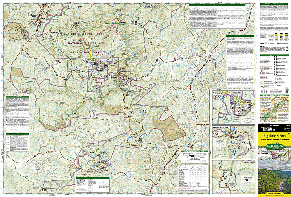
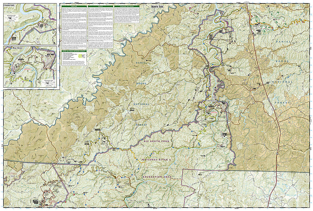
This Trails Illustrated topographic map for Big South Fork National River & Recreation Area in southern Kentucky and northern Tennessee is the perfect map for hiking, biking, exploring, climbing, camping, and sightseeing in this stunning area.
The map includes Daniel Boone National Forest, Big South Fork National River and Recreation Area, Scott State Forest, Cumberland River, Little South Fork, Big South Fork, and Clear Fork, New River, Lake Cumberland, Yahoo Falls Scenic Area, Blue Heron Area, Bandy Creek Campground, Leatherwood Ford, Honey Creek, Burnt Mill Bridge, Alum Ford, John Muir Trail, Bear Creek Overlook, and much more. Includes UTM grids for use with your GPS unit.
Product Features:
- Approximately 4" x 9" folded; 25" x 37" fully opened
- Scale =1:45,000
- Waterproof, tear-resistant
Requirements: None.
TIP:This item is also available in money-saving 2-packs and 3-packs! Go to our store, then browse our Discounted Multi-Packs Store category, or use the Store search tool to find items quickly.
You will receive: 1National GeographicTrails Illustrated Map.
Retailpackaging, shipped in a poly envelope. Shipping weight 4 oz.
If you have any questions or concerns, please contact us before or after the sale - we want you to be a happy customer!
Thanks for looking!