National Geographic
National Geographic MN Boundary Waters Map Bundle TI01020591B
National Geographic MN Boundary Waters Map Bundle TI01020591B
Couldn't load pickup availability
National Geographic Trails Illustrated Minnesota Boundary Waters Topo Map Bundle 1020591, which includes 2 maps: Maps 752 and 753. Great for Camping, Fishing, Hunting, Hiking, Backpacking, Family Outings, Outdoor Adventure.
The Boundary Waters was recognized for recreational opportunities in 1926, names the Superior Roadless Area in 1938, the BWCA in 1958, and federally designated under The Wilderness Act in 1964. It wasn't until October 21, 1978. The Boundary Waters Canoe Area Wilderness Act was established to provide specific guidance for managing the million plus acres of the Superior National Forest.
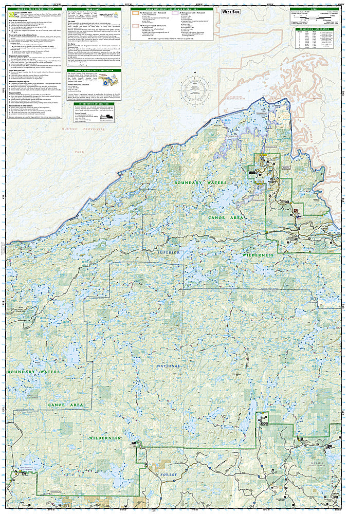
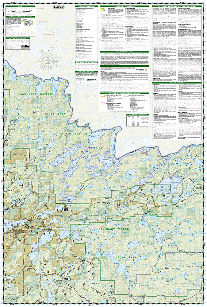
The BWCAW has changed little since the glaciers melted. With over 1,500 miles of canoe routes, nearly 2,200 designated campsites, and more than 1,000 lakes and streams waiting, the BWCAW draws over 250, 000 visitors each year. As part of the Superior National Forest, the BWCAW is managed by the US Forest Service.
Coverage Highlights
It includes both our Boundary Waters Canoe Area East and Boundary Water Canoe Area West Trails Illustrated maps, providing you coverage of the entire map and region, while saving you over 15%. Like all Trails Illustrated maps, the Boundary Waters Map Pack Bundle set is frequently revised and printed on waterproof, tear-resistant material to stand up to all conditions. This details topographic recreation map bundle contains carefully researched trails, campsites, forest service roads, and points-of-interests. Includes UTM grids for use with your GPS unit.
Product Features:
- Hiking trails, portages, cross-country, snowmobile and snowshoe trails, trail access locations, campgrounds and tent sites, birding, fishing, kayak, canoeing and power boating opportunities
- Ash River, Crane Lake, Kabetogama and Rainy Lake Visitor Centers
- Park Attractions: Gull Island Rookery, Grassy Bay Cliffs, Anderson Bay, Kettle Falls, Hoist Bay and Gold Portage
- Approximately 4.25" x 9.25" folded; 27" x 39" fully opened
- Scale = 1:75,000
- Waterproof, tear-resistant
This listing is for the Minnesota Boundary Waters Topo Map Bundle 1020591, which includes 2 maps: Maps 752 and 753.
Requirements: None.
You will receive: 2 National Geographic Trails Illustrated Maps.
Retail packaging, shipped in a poly envelope. Shipping weight 8 oz.
If you have any questions or concerns, please contact us before or after the sale - we want you to be a happy customer!
Thanks for looking!