National Geographic
National Geographic MT Glacier Waterton Map Bundle TI01020577B
National Geographic MT Glacier Waterton Map Bundle TI01020577B
Couldn't load pickup availability
National Geographic Trails Illustrated Montana Glacier / Waterton Lakes National Parks Topo Map Pack Bundle 1020577. Great for Camping, Fishing, Hunting, Hiking, Backpacking, Family Outings, Outdoor Adventure.
More than just a map, National Geographic Trails Illustrated topographic maps are designed to take you into the wilderness and back. Printed on tear-resistant, waterproof material, this map can go anywhere you do. Each map is based on exact reproductions of USGS topographic map information, updated, customized, and enhanced to meet the unique features of each area. The maps include valuable wilderness tips and Leave No Trace guidelines, along with updated trails, trailheads, points of interest, campgrounds, and much more. With a new color palette and stunning shaded relief, backcountry navigation has never been easier.
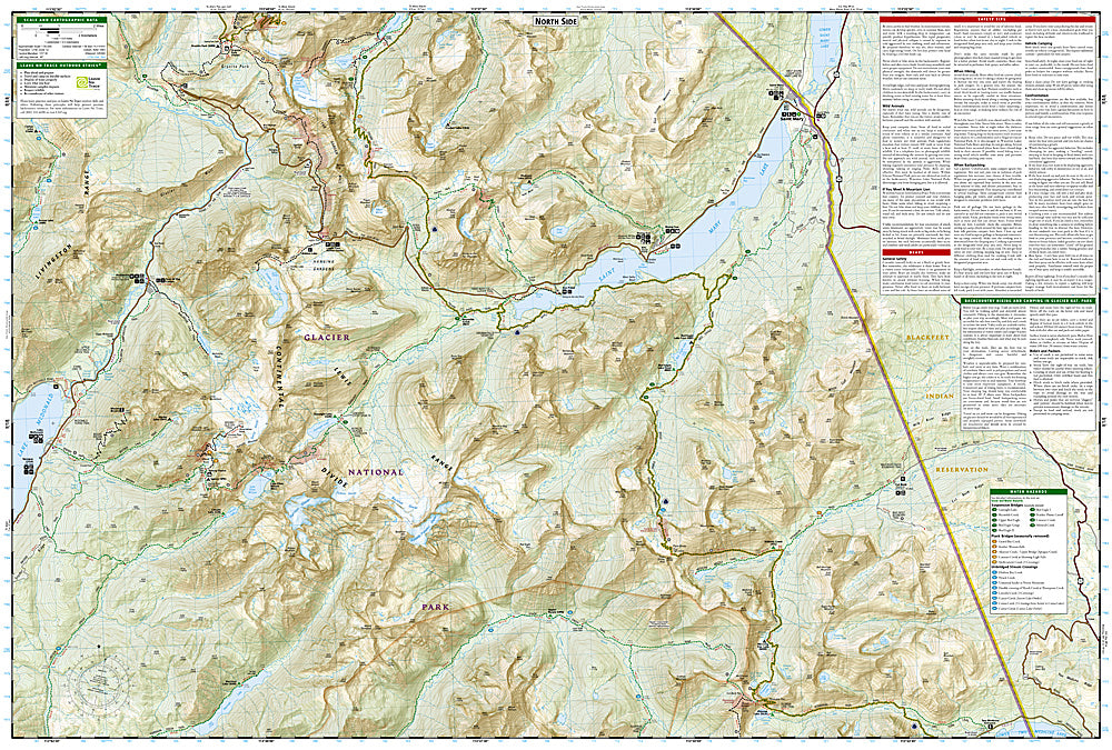
This listing is for the Montana Glacier / Waterton Lakes National Parks Topo Map Pack Bundle 1020577. This bundle includes 3 maps - 313, 314, and 315. To see details of these maps or for other states and maps visit our store.
The Montana Glacier / Waterton Lakes National Parks Trails Illustrated maps are the most comprehensive recreational maps for this beautiful area of Montana. Seeking the best combination of detailed maps and value for your Glacier / Waterton Lakes National Parks trip, then get our bundle pack. It includes three of our Glacier / Waterton Lakes National Parks sectional Trails Illustrated maps, providing you coverage of the entire map region, while saving you over 15%. Like all Trails Illustrated maps, the Glacier / Waterton Lakes National Parks Bundle set is frequently revised and printed on waterproof, tear-resistant material to stand up to all conditions. This detailed topographic recreation map bundle contains carefully researched trails, campsites, forest service roads, and points-of-interests. Includes UTM grids for use with your GPS unit. Coverage includes: Glacier National Park, Waterton Lakes National Park, North Fork, Many Glacier, Two Medicine, Pacific Northwest Trail and more.
Product Features:
- Approximately 4.25" x 7.5" folded; 22" x 32" fully opened
- Scale = 1:50,000
- Waterproof, tear-resistant
Requirements: None.
You will receive: 1 National Geographic Trails Illustrated Map Pack Bundle (3 maps).
Retail packaging, shipped in a poly envelope. Shipping weight 11 oz.
If you have any questions or concerns, please contact us before or after the sale - we want you to be a happy customer!
Thanks for looking!