National Geographic
National Geographic Trails Illustrated NC Linville Gorge Mount Mitchell Map TI00000779
National Geographic Trails Illustrated NC Linville Gorge Mount Mitchell Map TI00000779
Couldn't load pickup availability
National GeographicTrails Illustrated New Carolina Linville Gorge and Mount Mitchell Topo Map 779. Greatfor Camping, Fishing, Hunting,Hiking, Backpacking, Family Outings, Outdoor Adventure.
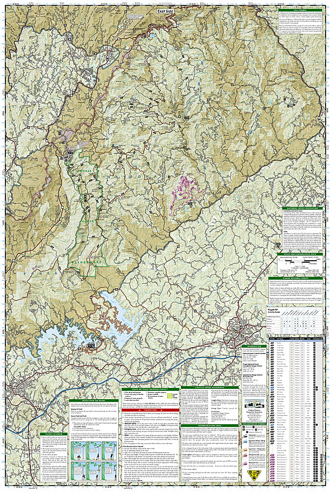
More than just a map, National Geographic Trails Illustrated topographic maps are designed to take you into the wilderness and back. Printed on tear-resistant, waterproof material, this map can go anywhere you do. Each map is based on exact reproductions of USGS topographic map information, updated, customized, and enhanced to meet the unique features of each area. The maps include valuable wilderness tips and Leave No Trace guidelines, along with updated trails, trailheads, points of interest, campgrounds, and much more. With a new color palette and stunning shaded relief, backcountry navigation has never been easier.
This listing is for theNew Carolina Linville Gorge and Mount Mitchell Topo Map 779.
Coverageincludes Pisgah National Forest, Grandfather Ranger District (complete) and Appalachian Ranger District. Towns: Black Mountain, Marion, Morganton, Linville, Burnsville.Wilderness areas: Linville Gorge.Scenic drives: Blue Ridge Parkway. Other highlights: MountMitchell State Park, Grandfather Mountain Biosphere Reserve, Wilson CreekWild and Scenic River, BrownMountain OHV Area,South ToeRiver,Mountains-to-Sea Trail, and Lake James State Park. Includes UTM grids for use with your GPS unit and trail mileage matrix.
Product Features:
- Approximately 4.25 x 9.25" folded; 26" x 38" fully opened
- Scale = 1:65,000
- Waterproof, tear-resistant
Requirements: None.
TIP: This item is also available in money-saving 2-packs and 3-packs! Go to our store, then browse our Discounted Multi-Packs Store category, or use the Store search tool to find items quickly.
You will receive: 1National GeographicTrails Illustrated Map.
Retailpackaging, shipped in a poly envelope. Shipping weight 4 oz.
If you have any questions or concerns, please contact us before or after the sale - we want you to be a happy customer!
Thanks for looking!