National Geographic Maps
National Geographic Pisgah Nat Forest Map Pack Bundle TI01021244B
National Geographic Pisgah Nat Forest Map Pack Bundle TI01021244B
Couldn't load pickup availability
BRAND NEW National Geographic Trails Illustrated North Carolina, Pisgah National Forest Topographic Map Pack Bundle.
• Waterproof • Tear-Resistant • Topographic Maps
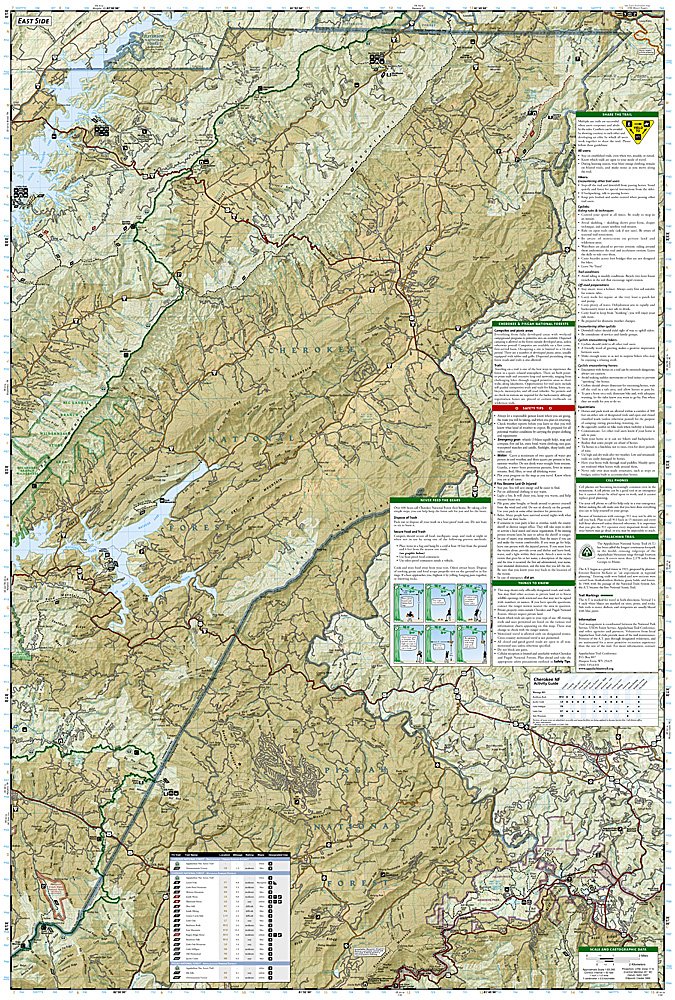
National Geographic's Trails Illustrated Map Pack Bundle of Pisgah National Forest covers a land of mile-high peaks, cascading waterfalls, and heavily forested slopes. Comprised of over 500,000 acres, the Pisgah is primarily a hardwood forest with whitewater rivers, waterfalls and hundreds of miles of trails. This national forest is home of the first tract of land purchased under the Weeks Act of 1911 which led to the creation of the national forests in the eastern United States. It is also home of the first school of forestry in the United States, now preserved at the Cradle of Forestry in America historic site, and boasts two of the first designated wilderness areas in the east. The Pisgah, Grandfather and Appalachian Ranger Districts are scattered along the eastern edge of the mountains of western North Carolina and offer visitors a variety of opportunities for outdoor recreation and enjoying the natural beauty of the mountains.
With miles of mapped trails including portions of the Appalachian Trail, these maps can guide you off the beaten path and back again in some of the most breathtaking scenery in the region. Extensive trail charts will help you choose a trail that's right for your activity level and recreation use whether you're hiking, horseback riding, or biking. The map base includes contour lines, shaded relief, and elevations for summits and passes.
Buy the Map Pack and save over 15%!
The Pisgah National Forest Map Pack includes:
Map 779 :: Linville Gorge, Mount Mitchell
Map 780 :: Pisgah Ranger District Map
Map 782 :: French Broad and Nolichucky Rivers
Map 783 :: South Holston and Watauga Lakes
Every Trails Illustrated map is printed on "Backcountry Tough" waterproof, tear-resistant paper. A full UTM grid is printed on the map to aid with GPS navigation.
Features:
- Waterproof, tear-resistant paper
- Accurate topography/terrain with clearly labeled details
- Full UTM grid for GPS use
- Includes regulations, permit info, and safety tips
- Hiking trail and backcountry road guides
- Route descriptions and mileages
- Detailed topographic map with contour lines, elevations, and shaded relief
- Water features with river mileage
- Mountain bike routes with degree of difficulty
- Campgrounds and campsites, scenic overlooks, and boat launch sites
- Model: TI01021244B
- Scale: varies - 1:65,000, 1:63,360, 1:50,000
- Folded Size: 4.25" x 9.25"
- Flat Size: 25.5" x 37.75"
- Weight: Approx. 3.4 oz each map
TIP: For lower prices on our maps, check out our promotions (click the link above the picture). Here is the info: Purchase 2 - 3 maps and get 10% off, 4 or more will get you 15% off! This promo includes ALL of our maps. For example, purchase 2 Trails Illustrated maps, 1 Destination map, and 1 Adventure map (total of 4) and get 15% off!! Just put everything in your shopping cart and you will see the savings!
Retail packaging, shipped in a poly envelope. Shipping weight 2 lbs.
If you have any questions or concerns, please contact us before or after the sale - we want you to be a happy customer!
Thanks for looking!