NA
National Geographic Trails Illustrated TN/NC Clingmans Dome Nat Park Map TI00000317
National Geographic Trails Illustrated TN/NC Clingmans Dome Nat Park Map TI00000317
Couldn't load pickup availability
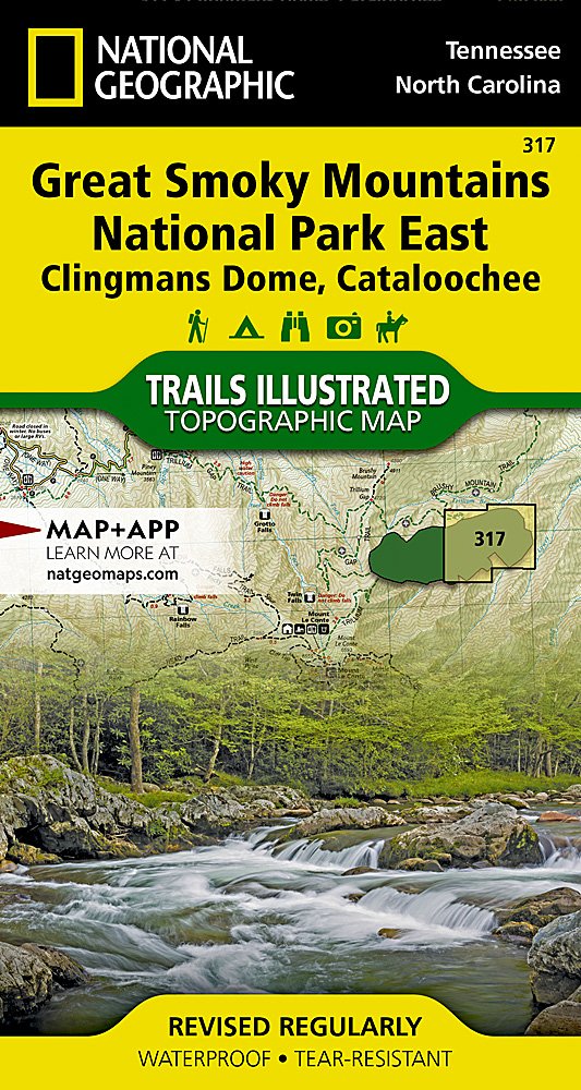
BRANDNEW National GeographicTrails Illustrated Tennessee/ North CarolinaClingmans Dome / Cataloochee, Great Smoky Mountains National Park Trail Topo Map 317.
Greatfor Camping, Fishing, Hunting,Hiking, Backpacking, Family Outings, Outdoor Adventure.
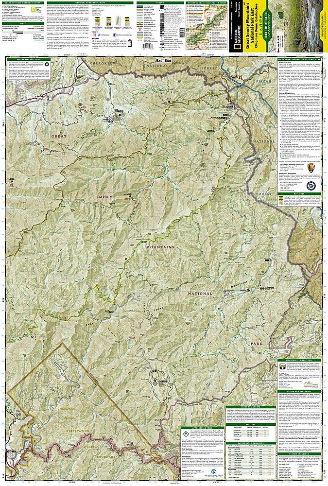
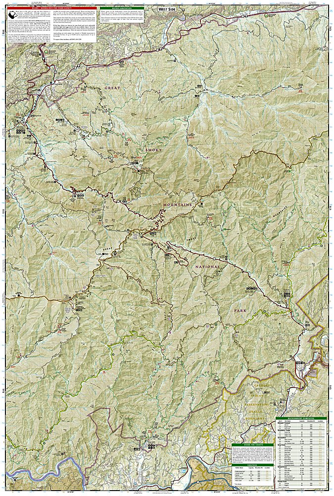
More than just a map, National Geographic Trails Illustrated topographic maps are designed to take you into the wilderness and back. Printed on tear-resistant, waterproof material, this map can go anywhere you do. Each map is based on exact reproductions of USGS topographic map information, updated, customized, and enhanced to meet the unique features of each area. The maps include valuable wilderness tips and Leave No Trace guidelines, along with updated trails, trailheads, points of interest, campgrounds, and much more. With a new color palette and stunning shaded relief, backcountry navigation has never been easier.
This listing is for theTennessee/ North CarolinaClingmans Dome / Cataloochee, Great Smoky Mountains National Park Trail Topo Map 317.
One of our more popular Trails Illustrated maps provides an increased scale of one of the most visited National Parks in the US and greater detail to the backcountry users and Appalachian Trail through-hikers.
Great Smoky Mountains National Park is a hikers paradise with over 800 miles of maintained trails ranging from short leg-stretchers to strenuous treks that may require backcountry camping. But hiking is not the only reason for visiting the Smokies. Car camping, fishing, picnicking, wildlife viewing and auto touring are popular activities.
Coverage Highlights for this and the related 317 map:
Appalachian Trail, Benton Mackaye Trail, Mountains-to-Sea Trail, Backcountry Campsites, Detailed Trail Mileages, Footbridges, Fords/Stream Crossings, Nature/Interpretive Trails, Scenic Overlooks/Roadside Pull-outs, Cades Cove Driving Loop, Chilowee Mountain, Little Mountain, and the Cataloochee Divide, Blue Ridge Parkway, National Forest Service Lands (Cherokee, Pisgah and Nantahala National Forests), Little Tennessee and Tuckasegee Rivers, Chilhowee and Fontana Lakes, Maryville Tennessee, Gatlinburg Tennessee, Waynesville North Carolina, and much more.
- Approximately 4.25" x 9" folded; 25 1/2" x 37 3/4" fully opened
- Scale: 1:40,000 (1" = 0.6 miles)
- Map revised - 2010
Requirements: None.
You will receive: 1National GeographicTrails Illustrated Map.
Retailpackaging, shipped in a poly envelope. Shipping weight 4 oz.
If you have any questions or concerns, please contact us before or after the sale - we want you to be a happy customer!
Thanks for looking!