

National Geographic
National Geographic Trails Illustrated TN Tellico and Ocoee Rivers Trail Map TI00000781
National Geographic Trails Illustrated TN Tellico and Ocoee Rivers Trail Map TI00000781
Couldn't load pickup availability
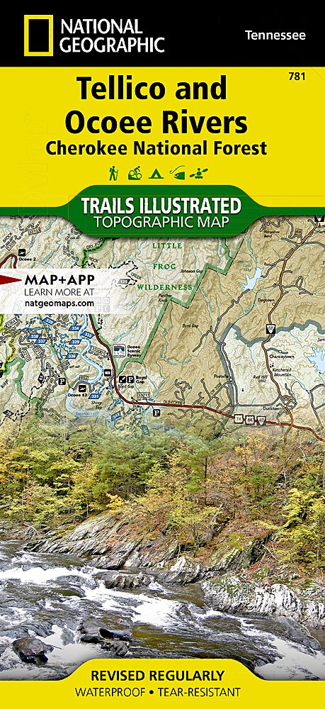
National GeographicTrails Illustrated Tennessee Tellico and Ocoee Rivers Trail Topo Map 781.
More than just a map, National Geographic Trails Illustrated topographic maps are designed to take you into the wilderness and back. Printed on tear-resistant, waterproof material, this map can go anywhere you do. Each map is based on exact reproductions of USGS topographic map information, updated, customized, and enhanced to meet the unique features of each area. The maps include valuable wilderness tips and Leave No Trace guidelines, along with updated trails, trailheads, points of interest, campgrounds, and much more. With a new color palette and stunning shaded relief, backcountry navigation has never been easier.
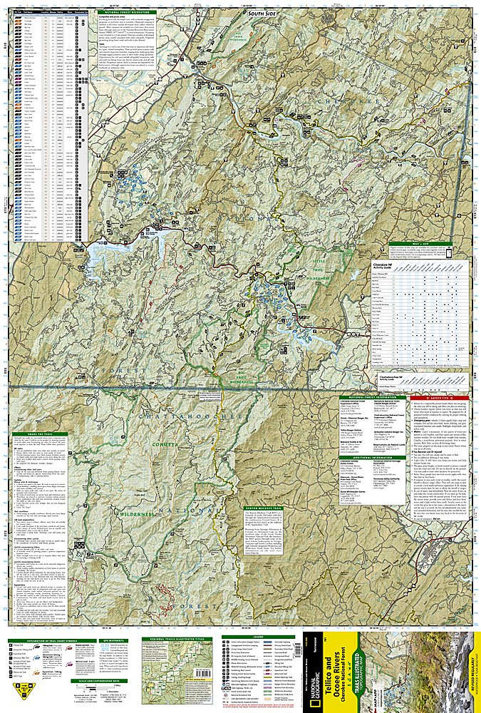
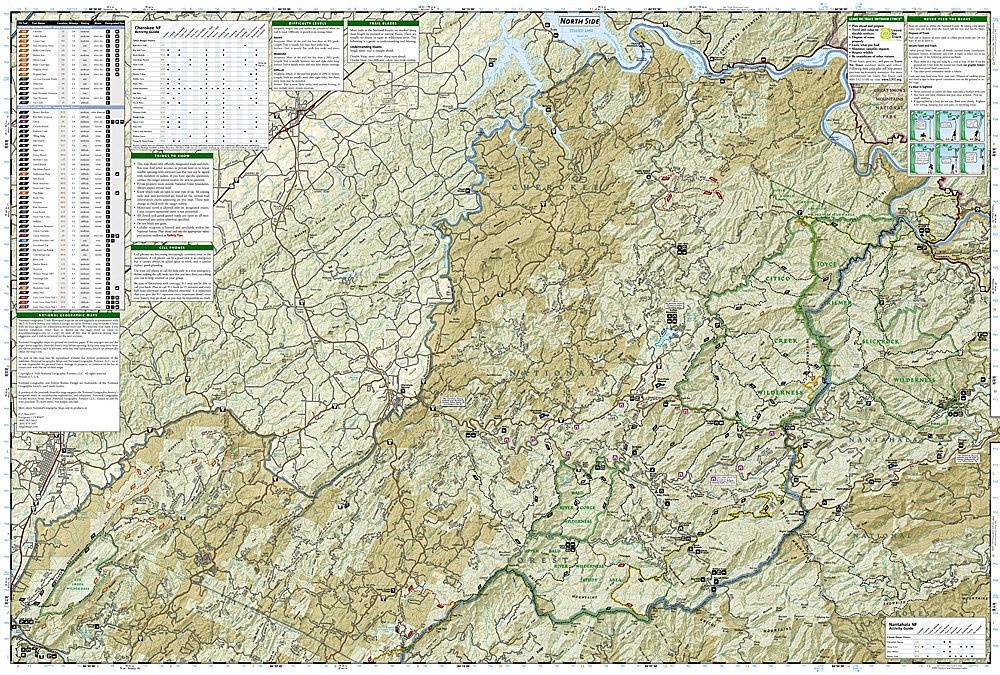
This Trails Illustrated topographic map is the most comprehensive recreational map for Tennessee's Cherokee National Forest, Southern Districts, Tellico and Ocoee Rivers, Cohutta Wilderness area.
Coverage includes Cherokee National Forest/Southern Districts, Cohutta wilderness areas, Ocoee Whitewater Center, Hiwassee State Scenic River, Ocoee Scenic Byway drive, Cherohala Skyway, Tellico Auto Wildlife Viewing Loop, John Muir National Recreation Trail,and more. Towns: Etowah, McCaysville. Joyce Kilmer Slickrock, Citico Creek, Bald River Gorge, Gee Creek, Big Frog, Little Frog.
Features:
- Approximately 4 1/4" x 9" folded; 25 1/2" x 37 3/4" fully opened
- Scale = 1:63,360
- Waterproof, tear-resistant
Requirements: None.
TIP:For lower prices on our maps, check out our promotions (click the link above the picture). Here is the info: Purchase 2 - 3 maps and get 10% off, 4 or more willget you 15% off! This promo includes ALL of our maps. For example, purchase 2 Trails Illustrated maps, 1 Destination map, and 1 Adventure map (total of 4) and get15% off!! Just put everything in your shopping cart and you will see the savings!
You will receive: 1National GeographicTrails Illustrated Map.
Retailpackaging, shipped in a poly envelope. Shipping weight 4 oz.
If you have any questions or concerns, please contact us before or after the sale - we want you to be a happy customer!
Thanks for looking!