NA
National Geographic Trails Illustrated UT Canyonlands Island in the Sky Map TI00000310
National Geographic Trails Illustrated UT Canyonlands Island in the Sky Map TI00000310
Couldn't load pickup availability
BRANDNEW National GeographicTrails Illustrated Utah Canyonlands- Island in the Sky District Topo Map 310. Greatfor Camping, Fishing, Hunting,Hiking, Backpacking, Family Outings, Outdoor Adventure.
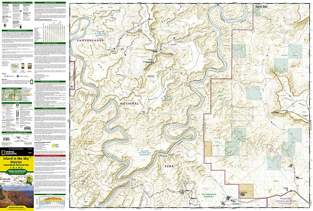
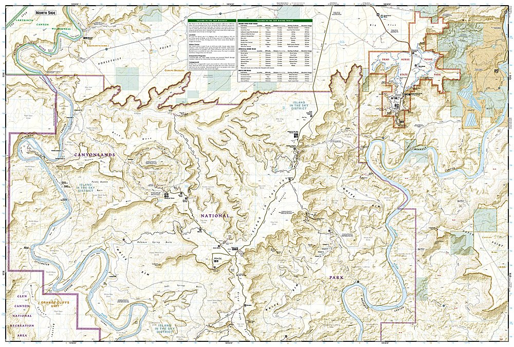
More than just a map, National Geographic Trails Illustrated topographic maps are designed to take you into the wilderness and back. Printed on tear-resistant, waterproof material, this map can go anywhere you do. Each map is based on exact reproductions of USGS topographic map information, updated, customized, and enhanced to meet the unique features of each area. The maps include valuable wilderness tips and Leave No Trace guidelines, along with updated trails, trailheads, points of interest, campgrounds, and much more. With a new color palette and stunning shaded relief, backcountry navigation has never been easier.
This listing is for theUtah Canyonlands- Island in the Sky District Topo Map 310.
Included on the map are Canyonlands National Park, the Island in the Sky district, the Needles district, and the Maze district. The map also covers the Colorado River, the Green River, Indian Creek Wilderness, Bridger Jack Mesa Wilderness, Butler Wash Wilderness, Canyon Rims Recreation Area, and provides fascinating information about the park's archaeology. Scenic views make this area ideal for any back-country outdoor activity. Includes UTM grids for use with your GPS unit.
Product Features:
- Approximately 4" x 9" folded; 25" x 37" fully opened
- Scale =1:100,000
- Waterproof, tear-resistant
Requirements: None.
TIP: This item is also available in money-saving 2-packs and 3-packs! Go to our store, then browse our Discounted Multi-Packs Store category, or use the Store search tool to find items quickly.
You will receive: 1National GeographicTrails Illustrated Map.
Retailpackaging, shipped in a poly envelope. Shipping weight 4 oz.
If you have any questions or concerns, please contact us before or after the sale - we want you to be a happy customer!
Thanks for looking!