

Beagle Outdoors
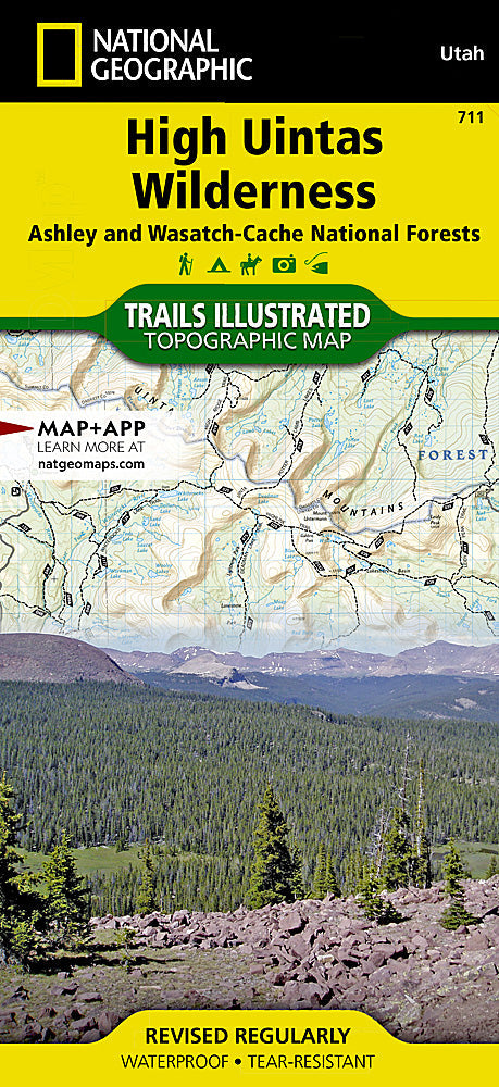
National Geographic Trails Illustrated Utah High Uintas Wilderness Map TI00000711
National Geographic Trails Illustrated Utah High Uintas Wilderness Map TI00000711
Couldn't load pickup availability
BRANDNEW National GeographicTrails Illustrated Utah High Uintas Wilderness Topo Map 711. Greatfor Camping, Fishing, Hunting,Hiking, Backpacking, Family Outings, Outdoor Adventure.
More than just a map, National Geographic Trails Illustrated topographic maps are designed to take you into the wilderness and back. Printed on tear-resistant, waterproof material, this map can go anywhere you do. Each map is based on exact reproductions of USGS topographic map information, updated, customized, and enhanced to meet the unique features of each area. The maps include valuable wilderness tips and Leave No Trace guidelines, along with updated trails, trailheads, points of interest, campgrounds, and much more. With a new color palette and stunning shaded relief, backcountry navigation has never been easier.
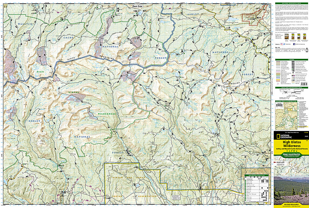
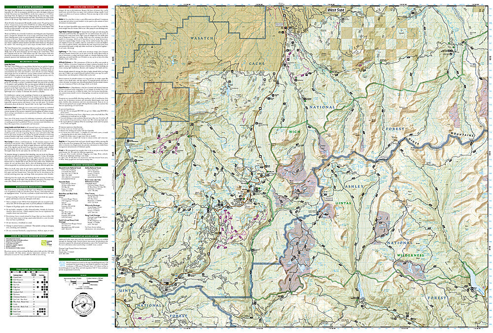
This Trails Illustrated topographic map is the most comprehensive recreational map for Utah's High Uintas Wilderness area. Coverage includes: Wasatch-Cache National Forest; the entire High Uintas Wilderness and surrounding backcountry; Hoop, Brown, Moon, Crystal, Little Lyman and Atwood lakes; Paradise Park, Cedar View, Upper Stillwater and Whitney reservoirs; Red Knob, Squaw, Smith Fork, Anderson, and Thompson passes.
Product Features:
- Approximately 4" x 9" folded; 25" x 37" fully opened
- Scale =1:100,000
- Waterproof, tear-resistant
Requirements: None.
You will receive: 1National GeographicTrails Illustrated Map.
Retailpackaging, shipped in a poly envelope. Shipping weight 4 oz.
If you have any questions or concerns, please contact us before or after the sale - we want you to be a happy customer!
Thanks for looking!