National Geographic
National Geographic Trails Illustrated Utah Ogden Monte Cristo Range Map TI00000700
National Geographic Trails Illustrated Utah Ogden Monte Cristo Range Map TI00000700
Couldn't load pickup availability
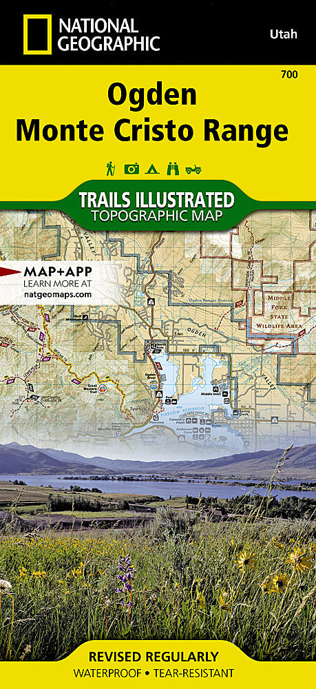
National GeographicTrails Illustrated Utah Ogden, Monte Cristo Range Trail Map 700. Greatfor Camping, Fishing, Hunting,Hiking, Backpacking, Family Outings, Outdoor Adventure.
National Geographic's Trails Illustrated map of Ogden, Monte Cristo Range in Utah is a two-sided, waterproof map designed to meet the needs of outdoor enthusiasts with unmatched durability and detail. This map was created in conjunction with local land management agencies and is loaded with valuable recreation information. Trails Illustrated maps are expertly researched and frequently updated. The maps are printed in the United States on durable synthetic paper, making them waterproof, tear-resistant, and trail toughcapable of going anywhere you do.
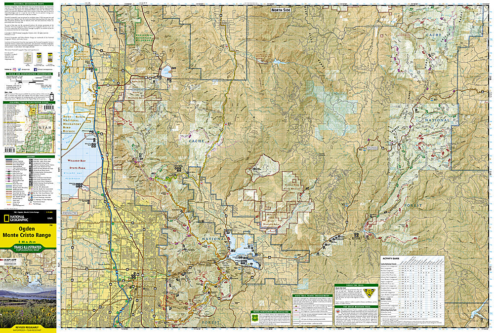
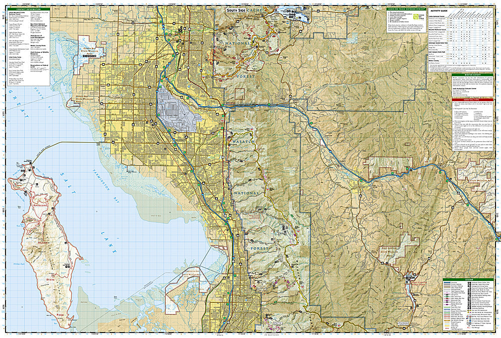
Coverage includes Cache and Wasatch national forests, Wellsville Mountain Wilderness, Ogden, Brigham City, Antelope Island State Park, and Bountiful. Pineview Reservoir with its many recreation points of intertest is also part of the map coverage. The trails in the Wasatch Range from Brigham City in the north to Bountiful in the south are all clearly shown. The recreation opportunities within the Monte Cristo Range are also a primary feature of this map. Includes UTM grids for use with your GPS unit.
Product Features:
- Clearly marked trails for hiking, biking, horseback riding, ATV and more
- Detailed topography and clearly defined, color-codedboundariesof state parks, national recreation areas, wilderness areas, marine sanctuaries and wildlife refuges
- Hundreds of points of interest, including scenic viewpoints, campgrounds, boat launches and canoe carry downs, swimming areas, fishing access points and more
- UTM and Latitude/Longitude grid, as well as selected waypoints and scale bar for easy and accurate navigation
- Detailed road network
- Useful travel information on parks and key trails
- 25 1/2" x 37 3/4" flat; 4 1/4" x 9 1/4" folded
- Scale: 1:75,000
- 2014
- Waterproof, tear-resistant
Retail packaging, shipped in a poly envelope. Shipping weight 4 oz.
Thanks for looking!
FEATURES
- Clearly marked trails for hiking, biking, horseback riding, ATV and more
- Detailed topography and clearly defined, color-codedboundariesof state parks, national recreation areas, wilderness areas, marine sanctuaries and wildlife refuges
- Hundreds of points of interest, including scenic viewpoints, campgrounds, boat launches and canoe carry downs, swimming areas, fishing access points and more
- UTM and Latitude/Longitude grid, as well as selected waypoints and scale bar for easy and accurate navigation
- Detailed road network
- Useful travel information on parks and key trails
- 25 1/2" x 37 3/4" flat; 4 1/4" x 9 1/4" folded
- Scale: 1:75,000
- 2014
- Waterproof, tear-resistant
Requirements: None.
You will receive: 1 National GeographicTrails Illustrated Map.
Retail packaging, shipped in a poly envelope. Shipping weight 4 oz.
If you have any questions or concerns, please contact us before or after the sale - we want you to be a happy customer!
Thanks for looking!


