NA
National Geographic Trails Illustrated VA Mount Rogers National Rec Area Map TI00000786
National Geographic Trails Illustrated VA Mount Rogers National Rec Area Map TI00000786
Couldn't load pickup availability
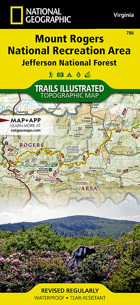
BRAND NEW National Geographic Trails IllustratedVirginia Mount Rogers National Recreation Area Map 786. Greatfor Camping, Fishing, Hunting,Hiking, Backpacking, Family Outings, Outdoor Adventure.
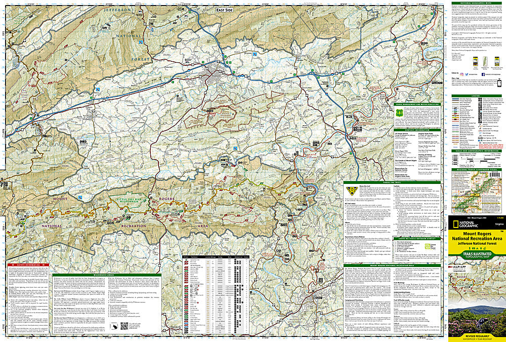
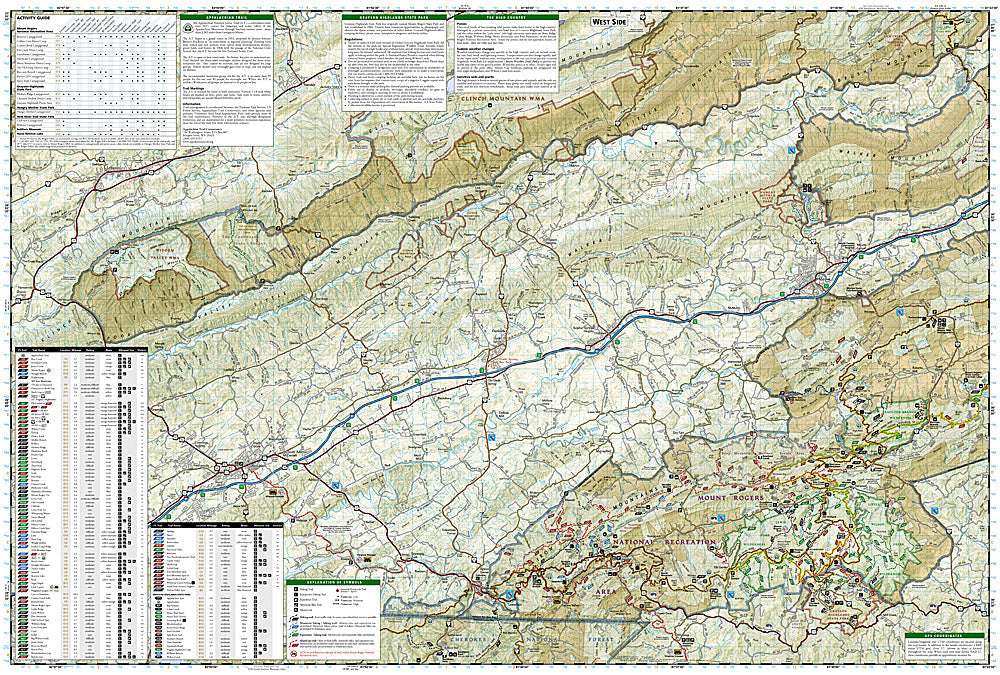
This Trails Illustrated topographic map is the most comprehensive recreational map for the Mount Rogers National Recreation Area in Virginia. Coverage includes: Jefferson National Forest; Lewis Fork, Little Dry Run, and Little Wildon Creek Wilderness areas; Grayson Highlands, Hungry Mother, and New River Trail State Parks; Appalachian National Scenic Trail, VA Creeper Trail, VA Highlands and Iron Mountain Horse Trails; Towns: Wytheville, Galax, Marion, Damascus, Abingdon.
This listing is forNational Geographic Trails IllustratedVirginia Mount Rogers National Recreation Area Map 786.
- Approximately 4 1/4" x 9" folded; 25 1/2" x 37 3/4" fully opened
- Scale = 1:35,000 and 1:75,000
- Map revised - 2003
Requirements: None.
TIP: This item is also available in money-saving 2-packs and 3-packs! Go to our store, then browse our Discounted Multi-Packs Store category, or use the Store search tool to find items quickly.
You will receive: 1National GeographicTrails Illustrated Map.
Retailpackaging, shipped in a poly envelope. Shipping weight 4 oz.
If you have any questions or concerns, please contact us before or after the sale - we want you to be a happy customer!
Thanks for looking!


