National Geographic
National Geographic Trails Illustrated VA Staunton / Shenandoah Valley Map TI00000791
National Geographic Trails Illustrated VA Staunton / Shenandoah Valley Map TI00000791
Couldn't load pickup availability
National Geographic Trails IllustratedVirginia / West VirginiaStaunton / Shenandoah Valley Map 791. Greatfor Camping, Fishing, Hunting,Hiking, Backpacking, Family Outings, Outdoor Adventure.
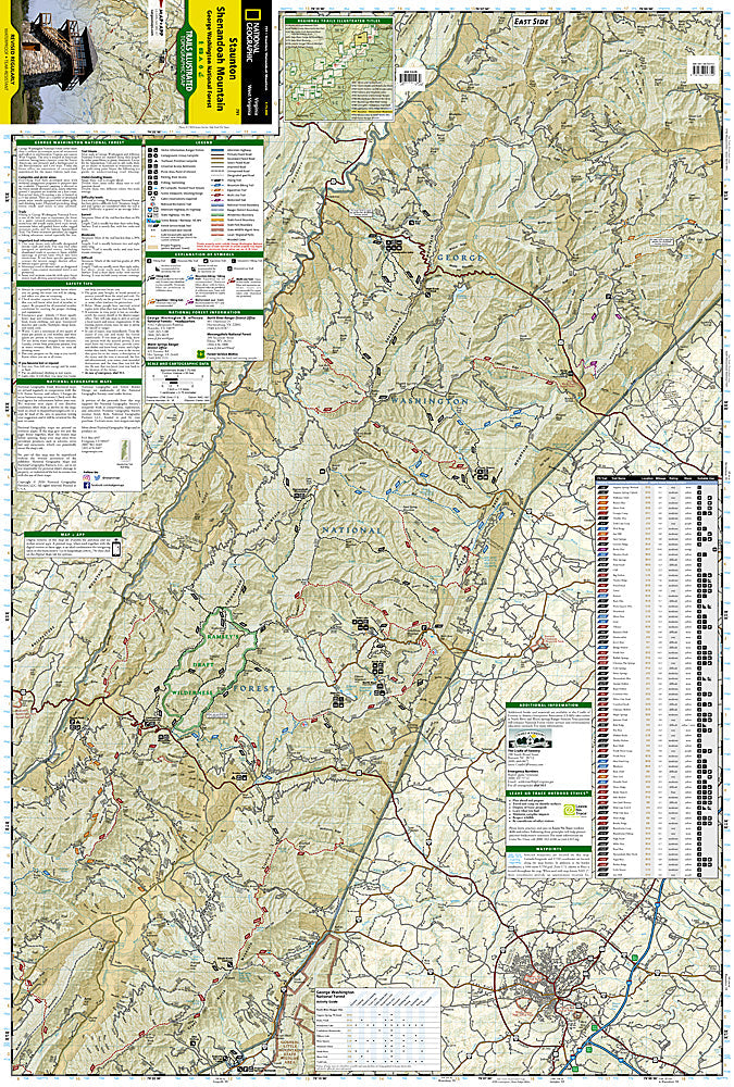
This Trails Illustrated topographic map is the most comprehensive recreational map for the Staunton/Shenandoah Mountain area of Virginia. Includes UTM grids for use with your GPS unit and a trail mileage matrix. Coverage includes: George Washington National Forest; the towns of Staunton and Warm Springs; Ramseys Draft Wilderness Area; the Todd Lake, Hidden Valley, Brandywine Lake, Hone Quarry, and Warm Springs recreation areas.
Product Features:
- Approximately 4" x 9" folded; 18 3/4" x 25 1/2" fully opened
- Scale: 1:70,000 (1 = 1.1 miles)
Requirements: None.
TIP: This item is also available in money-saving 2-packs and 3-packs! Go to our store, then browse our Discounted Multi-Packs Store category, or use the Store search tool to find items quickly.
You will receive: 1National GeographicTrails Illustrated Map.
Retailpackaging, shipped in a poly envelope. Shipping weight 4 oz.
If you have any questions or concerns, please contact us before or after the sale - we want you to be a happy customer!
Thanks for looking!