NA
National Geographic Trails Illustrated WV River Gorge National River Map TI00000242
National Geographic Trails Illustrated WV River Gorge National River Map TI00000242
Couldn't load pickup availability
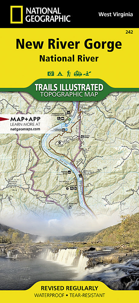
BRANDNEW National GeographicTrails IllustratedWest Virginia New River Gorge National River Map 242. Greatfor Camping, Fishing, Hunting,Hiking, Backpacking, Family Outings, Outdoor Adventure.
This Trails Illustrated topographic map for Big South Fork National River and Recreation Area in southern Kentucky and northern Tennessee is the perfect map for hiking, biking, exploring, climbing, camping, and sightseeing in this stunning area.
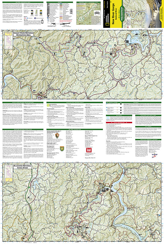
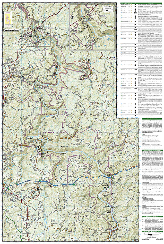
The map includes Daniel Boone National Forest, Big South Fork National River and Recreation Area, Scott State Forest, Cumberland River, Little South Fork, Big South Fork, and Clear Fork, New River, Lake Cumberland, Yahoo Falls Scenic Area, Blue Heron Area, Bandy Creek Campground, Leatherwood Ford, Honey Creek, Burnt Mill Bridge, Alum Ford, John Muir Trail, Bear Creek Overlook, and much more. Includes UTM grids for use with your GPS unit.
Product Features:
- Approximately 4.25" x 9.25" folded; 26" x 38" fully opened
- Scale =1:55,000
- Waterproof, tear-resistant
Requirements: None.
TIP: This item is also available in money-saving 2-packs and 3-packs! Go to our store, then browse our Discounted Multi-Packs Store category, or use the Store search tool to find items quickly.
This listing is forWest Virginia New River Gorge National River Map 242.
You will receive: 1National GeographicTrails Illustrated Map.
Retailpackaging, shipped in a poly envelope. Shipping weight 4 oz.
If you have any questions or concerns, please contact us before or after the sale - we want you to be a happy customer!
Thanks for looking!