National Geographic
National Geographic Adventure Map US Alaska AD00003117
National Geographic Adventure Map US Alaska AD00003117
Couldn't load pickup availability
BRAND NEW National Geographic US Alaska Adventure Travel Map.
• Waterproof • Tear-Resistant • Travel Map
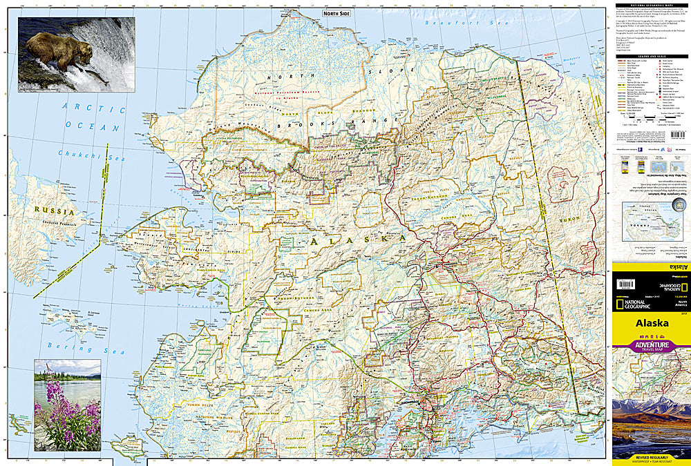
Alaska is a land so vast that is boggles the imagination. It is so large that it could easily contain the next three largest states: Texas, California, and Montana and still have room left over. Despite its large size Alaska has very few inhabitants making it the state with the lowest population density. Alaska is known for its dramatic, diverse terrain of wide-open spaces, mountains and forests, with abundant wildlife and many small towns.
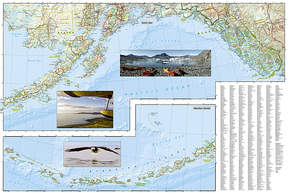
A majority of Alaska, sixty percent, is owned and managed by the Federal Government. These lands are open to the public and offer a wide range of activities from sightseeing in Denali National Park to river-running and fishing on one of many wild rivers. Many vistors to Alaska choose to arrive via cruise ship through the famous Inside Passage. The Alaska Adventure Map shows all of these features and more from the temperate rain forest in the Pan Handle to the arctic tundra of the North Slope. This is a state of diverse and wide open spaces that are still truly wild.
Alaska's most famous hotspots, like Denali, Anchorage, the Inside Passage, Klondike Gold Rush National Historical Park, and many others are clearly marked on the map. The boundaries of National Parks, National Forests, Natural Reserves and Wildlife Refuges are all clearly marked. With such a wealth of content, the map is an ideal complement to National Geographic's Inside Passage Destination Map or any other guidebook to the area.
Every Adventure Map is printed on durable synthetic paper, making them waterproof, tear-resistant and tough — capable of withstanding the rigors of international travel.
Features:
- Waterproof and tear-resistant
- Accurate topography/terrain with a clearly labeled road network
- Hundreds of points of interest, including the locations parks and nature reserves, protected lands, historical and cultural attractions
- Thousands of place names including towns and natural features; detailed place names index
- Important travel networks including airports, lighthouses, ferry routes and rail lines
- Updated regularly to ensure accuracy
- Scale: 1:2,250,000
- Folded Size: 4.25" x 9.25"
- Flat Size: 25.5" x 37.75"
- Weight: Approx. 3.4 oz
TIP: For lower prices on our maps, check out our promotions (click the link above the picture). Here is the info: Purchase 2 - 3 maps and get 10% off, 4 or more will get you 15% off! This promo includes ALL of our maps. For example, purchase 2 Trails Illustrated maps, 1 Destination map, and 1 Adventure map (total of 4) and get 15% off!! Just put everything in your shopping cart and you will see the savings!
Requirements: None.
You will receive: 1 National Geographic Adventure Travel Map.
OEM packaging, shipped in a poly envelope. Shipping weight 4 oz.
If you have any questions or concerns, please contact us before or after the sale - we want you to be a happy customer!
Thanks for looking!


