
National Geographic
National Geographic Utah San Rafael Swell Trails Illustrated Map TI00000712
National Geographic Utah San Rafael Swell Trails Illustrated Map TI00000712
Couldn't load pickup availability
National GeographicTrails IllustratedUtah San Rafael Swell Topo Map 712.
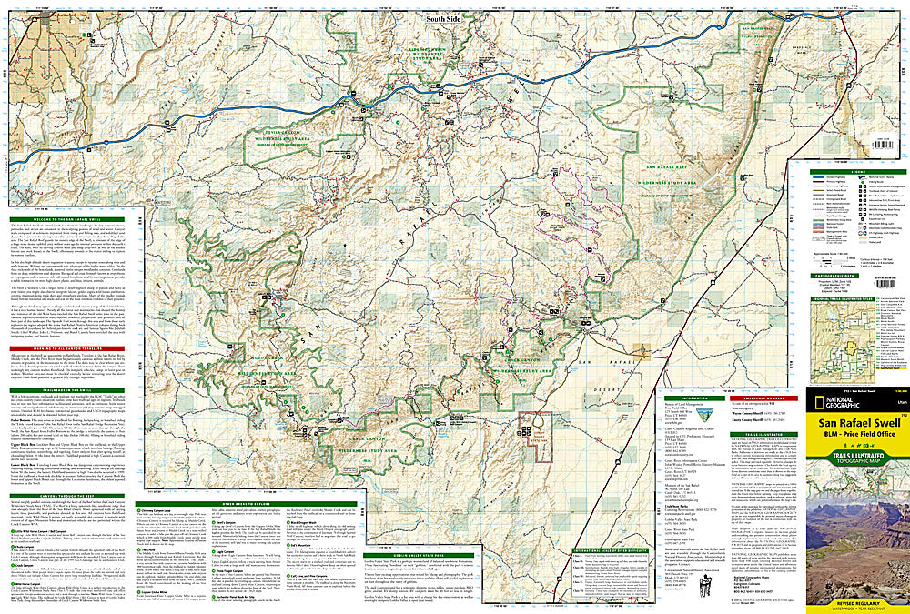
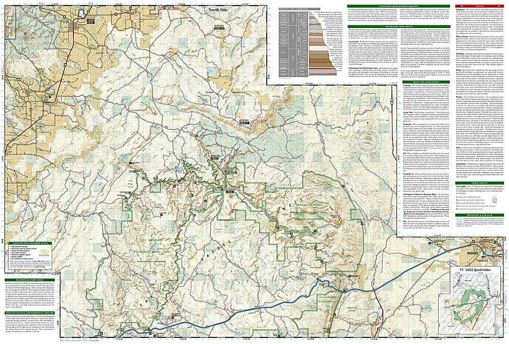
More than just a map, National Geographic Trails Illustrated topographic maps are designed to take you into the wilderness and back. Printed on tear-resistant, waterproof material, this map can go anywhere you do. Each map is based on exact reproductions of USGS topographic map information, updated, customized, and enhanced to meet the unique features of each area. The maps include valuable wilderness tips and Leave No Trace guidelines, along with updated trails, trailheads, points of interest, campgrounds, and much more. With a new color palette and stunning shaded relief, backcountry navigation has never been easier.
This Trails Illustrated topographic map is the most comprehensive and complete recreational map for Utah's San Rafael Swell area. Coverage includes: San Rafael Reef; Green River; Huntington; Castle Dale; Muddy Creek and San Rafael River; Upper and Lower Black Box; the Chute; Cedar Mountain; the Wedge; Sids Mountain Wilderness. Study Areas: San Rafael Reef; Crack Canyon; Muddy Creek; Devils Canyon; Sids Mountain; Mexican Mountain; Goblin Valley State Park; Cleveland-Lloyd Dinosaur Quarry.
Features:
- Approximately 4 1/4" x 9 1/4" folded; 25 1/2" x 37 3/4" fully opened
- Scale = 1:90,000
Requirements: None.
TIP:For lower prices on our maps, check out our promotions (click the link above the picture). Here is the info: Purchase 2 - 3 maps and get 10% off, 4 or more willget you 15% off! This promo includes ALL of our maps. For example, purchase 2 Trails Illustrated maps, 1 Destination map, and 1 Adventure map (total of 4) and get15% off!! Just put everything in your shopping cart and you will see the savings!
You will receive: 1National GeographicTrails Illustrated Map.
Retailpackaging, shipped in a poly envelope. Shipping weight 4 oz.
If you have any questions or concerns, please contact us before or after the sale - we want you to be a happy customer!
Thanks for looking!